Area Overview for DY4 8SY
Photos of DY4 8SY

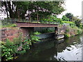
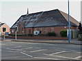
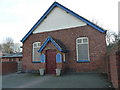
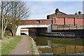
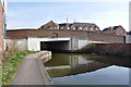
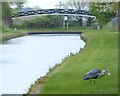
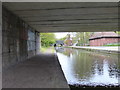
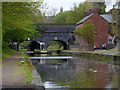

91 photos from this area
Area Information
Key information about the DY4 8SY including its size, population, and administrative classification.
- Area Type
- Postcode
- Area Size
- 4069 m²
- Population
- 1761
- Population Density
- 7904 people/km²
House Prices in DY4 8SY
18
Properties
£86,402
Average Sold Price
£36,000
Lowest Price
£181,000
Highest Price
Showing 18 properties
| Address | Type | Beds | Baths | Last Sale Price | Last Sale Date | |
|---|---|---|---|---|---|---|
| 17 Lister Close, Tipton, DY4 8SY | house | 2 | - | £163,000 | Oct 2025 | |
| 19 Lister Close, Tipton, DY4 8SY | Semi-detached | 2 | 1 | £181,000 | Dec 2024 | |
| 3 Lister Close, Tipton, DY4 8SY | Retail | 2 | 1 | £117,500 | Mar 2022 | |
| 11 Lister Close, Tipton, DY4 8SY | house | - | - | £86,000 | Nov 2021 | |
| 15 Lister Close, Tipton, DY4 8SY | Terraced | 2 | 1 | £124,000 | Jun 2020 | |
| 16 Lister Close, Tipton, DY4 8SY | Terraced | 2 | - | £64,500 | Jun 2014 | |
| 2 Lister Close, Tipton, DY4 8SY | house | 2 | - | £75,000 | Oct 2012 | |
| 7 Lister Close, Tipton, DY4 8SY | Semi-detached | - | - | £86,995 | Feb 2008 | |
| 8 Lister Close, Tipton, DY4 8SY | house | 2 | - | £99,950 | Jul 2007 | |
| 14 Lister Close, Tipton, DY4 8SY | Terraced | 2 | 1 | £96,995 | Sep 2006 |
Page 1 of 2
Energy Efficiency in DY4 8SY
Amenities
Schools
| Rank | School | Type | Entry gender | Ages |
|---|
Explore more schools in this area
Go to Schools tabDemographics
Household Size
One person
most common
Accommodation Type
Houses
most common
Tenure
37
majority
Ethnic Group
White
most common
Religion
N/A
most common
Household Composition
N/A
most common
Age
47
median
Adults (30-64 years)
most common
Household Deprivation
N/A
with no deprivation
NS-SEC
12
in Lower managerial occupations
Explore more demographic insights in this area
Go to Demographics tabPlanning
Planning Constraints
- Flood RiskPremium
- Ramsar Wetland SitesPremium
- Area of Outstanding Natural BeautyPremium
- Protected Nature ReservePremium
- Protected WoodlandPremium