Area Overview for DY4 8QP
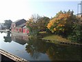
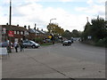
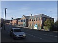
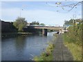
Photos of DY4 8QP
Area Information
DY4 8QP is a small residential postcode area in England, covering just 2774 square metres and home to 2066 residents. Its high population density — 744,678 people per square kilometre — reflects a compact, closely knit community. This area is defined by its proximity to transport networks, with five rail stations, five metro stops, and multiple retail hubs within easy reach. Daily life here is shaped by the surrounding infrastructure, offering residents a mix of practical convenience and limited open space. The area’s small size means that amenities and services are tightly clustered, making it easy to access shops, public transport, and local facilities. However, the high density also means that the community is highly dependent on these central points for services. While the area lacks natural reserves or protected landscapes, its strategic location near transport routes and retail centres makes it a practical choice for those prioritising connectivity and accessibility over expansive green spaces.
- Area Type
- Postcode
- Area Size
- 2774 m²
- Population
- 2066
- Population Density
- 5403 people/km²
The property market in DY4 8QP is characterised by a 46% home ownership rate, suggesting that nearly half of the housing stock is rented out. The accommodation type is predominantly houses, which may appeal to families or those seeking more space. However, the small area size and high population density indicate that properties are likely to be closely packed, with limited scope for expansion. This suggests that the market is more rental-focused than owner-occupied, potentially offering opportunities for investors or buyers seeking affordable housing. The compact nature of the area means that property values may be influenced more by proximity to transport and amenities than by size or land availability. Buyers should consider the practical implications of living in a densely populated area, where space is limited and community interactions are frequent.
House Prices in DY4 8QP
Showing 19 properties
| Address | Type | Beds | Baths | Last Sale Price | Last Sale Date | |
|---|---|---|---|---|---|---|
| 19 Downes Court, Tipton, DY4 8QP | Flat | 1 | 1 | £65,000 | Apr 2021 | |
| 7 Downes Court, Tipton, DY4 8QP | Terraced | 2 | 1 | - | - | |
| 4 Downes Court, Tipton, DY4 8QP | Terraced | 3 | 1 | - | - | |
| 18 Downes Court, Tipton, DY4 8QP | Flat | - | - | - | - | |
| 10 Downes Court, Tipton, DY4 8QP | Flat | - | - | - | - | |
| 17 Downes Court, Tipton, DY4 8QP | Flat | - | - | - | - | |
| 3 Downes Court, Tipton, DY4 8QP | Terraced | - | - | - | - | |
| 8 Downes Court, Tipton, DY4 8QP | house | - | - | - | - | |
| 9 Downes Court, Tipton, DY4 8QP | Terraced | - | - | - | - | |
| 16 Downes Court, Tipton, DY4 8QP | Flat | - | - | - | - |
Energy Efficiency in DY4 8QP
Living in DY4 8QP offers access to a range of essential amenities within practical reach. Retail options include Co-op Upper, Aldi Priory, and Morrisons Daily, providing everyday shopping needs. The area’s proximity to rail and metro stations — such as Coseley and Loxdale — ensures easy access to public transport, which is crucial for commuting or exploring further afield. While there is no mention of parks or leisure facilities in the data, the presence of multiple retail and transport hubs suggests a functional, service-oriented lifestyle. The compact nature of the area means that residents can walk or cycle to most amenities, reducing reliance on cars. This convenience, however, comes with the trade-off of limited green spaces, which may appeal more to those prioritising accessibility over natural environments.
Amenities
Schools
| Rank | School | Type | Entry gender | Ages |
|---|
Explore more schools in this area
Go to Schools tabDemographics
The community in DY4 8QP is predominantly composed of adults aged 30-64, with a median age of 47. This suggests a mature population, likely with established careers and families. Home ownership rates here are 46%, which is lower than the national average, indicating a mix of owner-occupied and rental properties. The accommodation types are primarily houses, though the exact proportion of flats or other dwellings is not specified. The predominant ethnic group is White, with no data provided on other demographics. The high population density — 744,678 people per square kilometre — implies that the area is heavily populated relative to its size, which could influence the availability of housing and community dynamics. This density may also affect the pace of life, with a focus on shared resources and communal spaces.
Household Size
Accommodation Type
Tenure
Ethnic Group
Religion
Household Composition
Age
Household Deprivation
NS-SEC
Explore more demographic insights in this area
Go to Demographics tabPlanning
Planning Constraints
- Flood RiskPremium
- Ramsar Wetland SitesPremium
- Area of Outstanding Natural BeautyPremium
- Protected Nature ReservePremium
- Protected WoodlandPremium