Area Overview for DY4 8PW
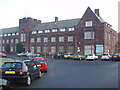
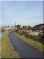
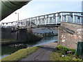
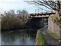
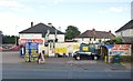
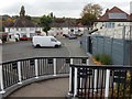
Photos of DY4 8PW


Area Information
Living in DY4 8PW means being part of a compact, residential cluster in England, where 1,708 people reside across 2.0 hectares. The area’s high population density of 86,659 people per square kilometre reflects a tightly knit community, though its small size means it is not a sprawling suburb. The median age of 47 suggests a mature population, with the majority of residents aged 30–64, indicating a stable demographic profile. Daily life here is shaped by proximity to essential services and transport links, with rail stations like Tipton and Dudley Port within reach. The area’s low flood risk and crime score of 68 make it an attractive option for those prioritising safety. While the housing stock is predominantly owner-occupied at 40%, the focus on homes rather than flats suggests a traditional, family-oriented environment. For buyers, the challenge lies in the limited size of the area, but the mix of amenities and connectivity offers a practical, grounded lifestyle.
- Area Type
- Postcode
- Area Size
- 2.0 hectares
- Population
- 1708
- Population Density
- 4344 people/km²
The property market in DY4 8PW is characterised by a 40% home ownership rate, with houses making up the majority of accommodation types. This suggests a market skewed towards owner-occupied homes rather than rental properties, though the exact proportion of rentals is not specified. The small area size means the housing stock is limited, which could affect availability for buyers seeking larger properties. The focus on houses rather than flats indicates a traditional, perhaps older housing stock, which may appeal to those prioritising space and privacy. However, the compact nature of the area means buyers should consider the proximity of neighbours and the potential for limited expansion. For those seeking a family home, the presence of primary and special schools nearby may be a key factor in decision-making.
House Prices in DY4 8PW
Showing 62 properties
| Address | Type | Beds | Baths | Last Sale Price | Last Sale Date | |
|---|---|---|---|---|---|---|
| 50 Leasowe Road, Tipton, DY4 8PW | Semi-detached | 3 | 1 | £175,000 | Jun 2025 | |
| 40 Leasowe Road, Tipton, DY4 8PW | Flat | - | - | £75,500 | Apr 2025 | |
| 38 Leasowe Road, Tipton, DY4 8PW | Flat | - | - | £72,500 | Apr 2025 | |
| 58 Leasowe Road, Tipton, DY4 8PW | Semi-detached | 2 | - | £115,000 | Mar 2025 | |
| 35 Leasowe Road, Tipton, DY4 8PW | Semi-detached | 3 | 1 | £161,000 | Jul 2024 | |
| 56 Leasowe Road, Tipton, DY4 8PW | Semi-detached | 3 | 2 | £150,000 | Apr 2023 | |
| 52 Leasowe Road, Tipton, DY4 8PW | house | - | - | £165,000 | Jan 2021 | |
| 48 Leasowe Road, Tipton, DY4 8PW | Maisonette | 2 | 1 | £72,000 | Sep 2020 | |
| 29 Leasowe Road, Tipton, DY4 8PW | house | - | - | £120,000 | Aug 2019 | |
| 25 Leasowe Road, Tipton, DY4 8PW | Terraced | 3 | 2 | £90,000 | Aug 2019 |
Energy Efficiency in DY4 8PW
Daily life in DY4 8PW is shaped by its proximity to retail, transport, and community hubs. Nearby shops include Aldi Priory, Tesco Dudley, and Morrisons Daily, offering essential goods and services. The area’s rail and metro stations—such as Tipton Railway Station and Bradley Lane—provide easy access to commuting and regional travel. While the data does not specify parks or leisure facilities, the presence of multiple schools and retail outlets suggests a focus on practicality over expansive recreational spaces. The compact nature of the area means amenities are closely clustered, reducing travel time for errands and social activities. For residents, this translates to a lifestyle that prioritises convenience, though those seeking larger green spaces may need to look beyond the immediate vicinity.
Amenities
Schools
Residents of DY4 8PW have access to a range of schools, including primary institutions such as Victoria Infant School, Tipton Green Junior School, and Sacred Heart Catholic Primary School. These schools cater to younger children, offering a mix of state-funded and faith-based education. For older students, Silvertrees Academy and Compass Community School Victoria Park provide secondary and special educational needs support, both with Ofsted ratings of ‘good’. The presence of both primary and special schools indicates a comprehensive educational offering, though the absence of secondary schools within the immediate area may require families to consider commuting. This mix ensures options for different stages of education, but the lack of data on school catchment areas means prospective buyers should verify proximity to specific institutions.
| Rank | School | Type | Entry gender | Ages |
|---|
Explore more schools in this area
Go to Schools tabDemographics
DY4 8PW’s population is dominated by adults aged 30–64, with a median age of 47, reflecting a mature, settled community. Home ownership stands at 40%, indicating a balance between owner-occupied properties and rental units. The area’s accommodation is primarily houses, which aligns with the traditional housing stock typical of smaller residential clusters. The predominant ethnic group is White, though specific data on diversity is not provided. The population density of 86,659 people per square kilometre highlights a compact, possibly high-pressure living environment, though this does not necessarily correlate with deprivation, which is not quantified here. For residents, this density means proximity to services but also a need for efficient use of space. The age profile suggests a community focused on stability, with fewer young families or retirees compared to other areas.
Household Size
Accommodation Type
Tenure
Ethnic Group
Religion
Household Composition
Age
Household Deprivation
NS-SEC
Explore more demographic insights in this area
Go to Demographics tabPlanning
Planning Constraints
- Flood RiskPremium
- Ramsar Wetland SitesPremium
- Area of Outstanding Natural BeautyPremium
- Protected Nature ReservePremium
- Protected WoodlandPremium