Area Overview for DY4 8PR
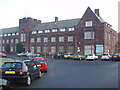
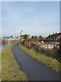
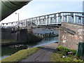
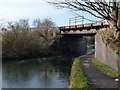
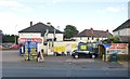
Photos of DY4 8PR


Area Information
DY4 8PR is a compact residential postcode in England, covering just 2.4 hectares and home to 1708 residents. Its high population density of 71,284 people per square kilometre reflects a tightly knit community, though the area’s small size means it is not a sprawling suburb but a focused cluster of homes. The neighbourhood is defined by its mature demographic, with a median age of 47 and most residents falling into the 30–64 age bracket. This suggests a stable, established population, likely with long-term ties to the area. Daily life here is shaped by proximity to essential services, including multiple schools, retail outlets, and transport links. While the area lacks large-scale amenities, its compact nature ensures that residents can access nearby towns and facilities with ease. The absence of protected natural sites or planning constraints means development is not restricted, though the focus remains on residential living. For buyers, DY4 8PR offers a blend of practicality and community, with homes primarily in private ownership and a strong emphasis on local infrastructure.
- Area Type
- Postcode
- Area Size
- 2.4 hectares
- Population
- 1708
- Population Density
- 4344 people/km²
The property market in DY4 8PR is characterised by a 40% home ownership rate, with houses forming the predominant accommodation type. This suggests a mix of owner-occupied and rental properties, though the relatively low home ownership percentage may indicate a stronger rental market compared to other areas. Given the postcode’s small size of 2.4 hectares, the housing stock is limited, meaning buyers should expect competition for available properties. The focus on houses rather than flats or apartments implies a preference for private, standalone homes, which may appeal to families or individuals seeking space. However, the compact nature of the area means that developments are likely to be modest in scale. For buyers, this small cluster of homes offers a chance to secure a property in a stable, well-connected location, though the limited supply could drive prices upward. Those considering the area should also factor in the proximity to nearby towns, which may influence property values and desirability.
House Prices in DY4 8PR
Showing 32 properties
| Address | Type | Beds | Baths | Last Sale Price | Last Sale Date | |
|---|---|---|---|---|---|---|
| 8 Manor Road, Tipton, DY4 8PR | house | - | - | £152,000 | Jul 2023 | |
| 22 Manor Road, Tipton, DY4 8PR | house | - | - | £132,000 | Nov 2021 | |
| 2C Manor Road, Tipton, DY4 8PR | Semi-detached | 3 | 1 | £175,000 | Oct 2020 | |
| 2D Manor Road, Tipton, DY4 8PR | house | - | - | £158,000 | Aug 2018 | |
| 2 Manor Road, Tipton, DY4 8PR | Terraced | 3 | 1 | £120,000 | Aug 2017 | |
| 21 Manor Road, Tipton, DY4 8PR | house | - | - | £68,000 | Dec 2013 | |
| 9 Manor Road, Tipton, DY4 8PR | Terraced | - | - | £87,950 | Apr 2005 | |
| 7 Manor Road, Tipton, DY4 8PR | Terraced | - | - | £36,995 | Mar 2000 | |
| Manor House, Manor Road, Tipton, DY4 8PR | Detached | 2 | 1 | - | - | |
| 2, Bungalow, Manor Road, Tipton, DY4 8PR | Unknown | - | - | - | - |
Energy Efficiency in DY4 8PR
Daily life in DY4 8PR is shaped by its proximity to essential amenities, including five retail outlets such as Morrisons Daily, Co-op Upper, and Tesco Dudley, which cater to shopping and household needs. The area’s rail and metro connections, including Tipton Railway Station and Bradley Lane, provide access to nearby towns and employment opportunities. While there is no mention of parks or leisure facilities in the data, the absence of planning constraints suggests that open spaces may be available nearby. The compact nature of the area means that residents can reach services quickly, fostering a convenient lifestyle. The mix of retail, transport, and educational facilities creates a self-contained environment, though those seeking larger leisure options may need to venture to adjacent towns. For those prioritising practicality and accessibility, DY4 8PR offers a straightforward, functional living experience.
Amenities
Schools
Residents of DY4 8PR have access to a range of primary and special schools, including Victoria Infant School, Tipton Green Junior School, Sacred Heart Catholic Primary School, and Compass Community School Victoria Park. These institutions cater to younger children, with the latter two offering special educational needs support. The Silvertrees Academy, an academy with a good Ofsted rating, provides secondary education. The mix of school types ensures families can choose between mainstream and specialist provision, though the absence of secondary schools within the postcode itself means students may need to commute to nearby towns. The good Ofsted ratings for both Silvertrees Academy and Compass Community School suggest a reliable standard of education, which is a key consideration for families prioritising schooling. However, the limited number of schools in the immediate area may require careful planning for catchment areas and transportation.
| Rank | School | Type | Entry gender | Ages |
|---|
Explore more schools in this area
Go to Schools tabDemographics
The population of DY4 8PR is predominantly composed of adults aged 30–64, with a median age of 47. This indicates a mature, settled community with fewer young families or elderly residents compared to other areas. Home ownership stands at 40%, suggesting that a significant portion of the housing stock is rented, which may influence the local rental market. The accommodation type is largely houses, implying a mix of family homes and smaller residences. The predominant ethnic group is White, with no data provided on other demographics. The high population density, while reflecting a close-knit environment, may also mean limited space for expansion. For quality of life, the absence of deprivation data means it is unclear whether residents face economic challenges, but the low crime risk score of 68 suggests a generally safe environment. This combination of stability and accessibility makes DY4 8PR a practical choice for those prioritising convenience over sprawling living spaces.
Household Size
Accommodation Type
Tenure
Ethnic Group
Religion
Household Composition
Age
Household Deprivation
NS-SEC
Explore more demographic insights in this area
Go to Demographics tabPlanning
Planning Constraints
- Flood RiskPremium
- Ramsar Wetland SitesPremium
- Area of Outstanding Natural BeautyPremium
- Protected Nature ReservePremium
- Protected WoodlandPremium