Area Overview for DY4 8ND
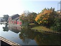
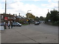
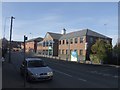
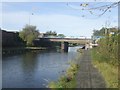
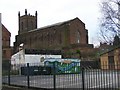
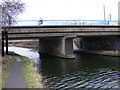
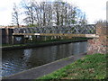
Photos of DY4 8ND

Area Information
DY4 8ND is a compact residential postcode in England, covering just 2.3 hectares yet housing 1,708 residents. Its high population density of 75,734 people per square kilometre reflects a tightly knit community, where daily life is shaped by proximity to local amenities and services. The area is characterised by a mature demographic, with a median age of 47 and a majority of residents aged 30–64. This suggests a stable, established population, likely drawn from families and professionals seeking a quieter, community-focused environment. The small area size means residents are close to essential services, including schools, retail, and transport hubs, which contributes to a convenient, self-contained lifestyle. While the area is not expansive, its density ensures that residents can access nearby facilities without long commutes. The presence of multiple rail and metro stations within practical reach further enhances connectivity, making DY4 8ND a viable option for those balancing local living with broader regional access.
- Area Type
- Postcode
- Area Size
- 2.3 hectares
- Population
- 1708
- Population Density
- 4344 people/km²
The property market in DY4 8ND is dominated by houses, with 40% of residents owning their homes. This suggests a mix of owner-occupied properties and rental units, though the exact balance of the latter is not specified. The small area size means the housing stock is limited, potentially creating a competitive market for buyers. The predominance of houses over flats or apartments indicates a focus on family-friendly, traditional housing, which may appeal to those prioritising space and privacy. However, the 40% home ownership rate implies that a significant portion of the area’s housing is available for rent, which could influence pricing dynamics and availability. Buyers considering DY4 8ND should be mindful of the area’s compact nature, as property choices may be constrained by proximity to nearby amenities and transport links. The lack of high-density housing also means that the area is unlikely to cater to those seeking urban living or larger investment properties.
House Prices in DY4 8ND
Showing 16 properties
| Address | Type | Beds | Baths | Last Sale Price | Last Sale Date | |
|---|---|---|---|---|---|---|
| 16 Queens Road, Tipton, DY4 8ND | Detached | 3 | 1 | £290,000 | May 2024 | |
| 24A Queens Road, Tipton, DY4 8ND | house | - | - | £167,500 | Jun 2021 | |
| 14 Queens Road, Tipton, DY4 8ND | Bungalow | 2 | 2 | £190,000 | Sep 2019 | |
| 28 Queens Road, Tipton, DY4 8ND | Semi-detached | 2 | - | £100,000 | Mar 2016 | |
| 30 Queens Road, Tipton, DY4 8ND | Semi-detached | 3 | 2 | £85,000 | Jul 2014 | |
| 22 Queens Road, Tipton, DY4 8ND | Semi-detached | 2 | - | £90,000 | Mar 2014 | |
| 22A Queens Road, Tipton, DY4 8ND | Semi-detached | 1 | - | £90,000 | Jun 2013 | |
| 24 Queens Road, Tipton, DY4 8ND | Semi-detached | - | - | £80,000 | Nov 2004 | |
| 32 Queens Road, Tipton, DY4 8ND | Bungalow | 4 | 3 | - | - | |
| 16B Queens Road, Tipton, DY4 8ND | undefined | - | - | - | - |
Energy Efficiency in DY4 8ND
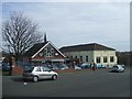
Living in DY4 8ND offers a blend of practicality and accessibility, with amenities within easy reach. The area is served by five retail outlets, including Co-op Upper, Morrisons Daily, and Tesco Dudley, providing essential shopping options for daily needs. The proximity of rail and metro stations, such as Tipton and Wednesbury Parkway, ensures that residents can easily access public transport for travel beyond the immediate area. While the data does not specify parks or leisure facilities, the compact nature of the postcode suggests that local green spaces or community hubs may be nearby. The presence of multiple schools and retail options indicates a focus on family-friendly living, where daily routines can be managed without long journeys. The high population density may foster a sense of community, though the lack of detailed information on leisure facilities means residents may need to look slightly further afield for recreational activities.
Amenities
Schools
DY4 8ND is served by a range of primary and special schools, offering families multiple educational options. Victoria Infant School and Tipton Green Junior School provide traditional primary education, while Sacred Heart Catholic Primary School adds a faith-based alternative. Silvertrees Academy, a good-rated academy, and Compass Community School, a special school with a good Ofsted rating, cater to broader needs, including specialist provisions for students with additional requirements. The mix of school types ensures that families can choose between mainstream education, faith-based institutions, and tailored support for children with specific learning needs. The presence of two schools with good Ofsted ratings suggests a generally high standard of education in the area, though parents should consider the specific curriculum and resources available at each institution. The proximity of these schools to the area reinforces its appeal for families prioritising access to quality education.
| Rank | School | Type | Entry gender | Ages |
|---|
Explore more schools in this area
Go to Schools tabDemographics
The community in DY4 8ND is predominantly composed of adults aged 30–64, with a median age of 47. This age profile indicates a settled population, likely with established careers and families. Home ownership stands at 40%, meaning 60% of residents are likely to rent, which may reflect a mix of long-term residents and those in transitional housing. The accommodation type is primarily houses, suggesting a more traditional, family-oriented housing stock compared to apartment blocks. The predominant ethnic group is White, though no specific data on diversity beyond this is provided. With a population density of 75,734 people per square kilometre, the area is densely populated, which may influence the pace of life and availability of shared community spaces. The relatively low home ownership rate could indicate a rental market that caters to both local workers and commuters, though the specific socioeconomic factors driving this are not detailed.
Household Size
Accommodation Type
Tenure
Ethnic Group
Religion
Household Composition
Age
Household Deprivation
NS-SEC
Explore more demographic insights in this area
Go to Demographics tabPlanning
Planning Constraints
- Flood RiskPremium
- Ramsar Wetland SitesPremium
- Area of Outstanding Natural BeautyPremium
- Protected Nature ReservePremium
- Protected WoodlandPremium