Area Overview for DY4 8HU
Photos of DY4 8HU


Area Information
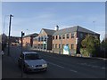
DY4 8HU is a small, tightly knit residential area in England, home to 1,868 people. Its compact size means it feels more like a village than a sprawling suburb, with a quiet, settled atmosphere. The area’s population is predominantly adults aged 30-64, suggesting a mature community with established families and professionals. Living here offers a balance of privacy and proximity to essential services. The postcode covers a cluster of homes, likely semi-detached or terraced properties, given the high home ownership rate. Daily life is shaped by the surrounding infrastructure: nearby rail stations, retail outlets, and transport links make it practical for commuters or those who prefer a slower pace. While the area lacks natural landmarks or protected sites, its low flood risk and manageable crime score of 73/100 contribute to a sense of security. For buyers seeking a stable, low-maintenance environment with good connectivity, DY4 8HU provides a straightforward, no-frills option.
- Area Type
- Postcode
- Area Size
- Not available
- Population
- 1868
- Population Density
- 7154 people/km²
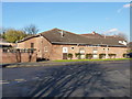
DY4 8HU is a predominantly owner-occupied area, with 52% of homes owned by residents. The accommodation type is primarily houses, suggesting a mix of semi-detached, terraced, or detached properties. This contrasts with areas dominated by rental properties or high-density housing. Given the small population and limited postcode area, the housing stock is likely modest in scale, with limited new developments. Buyers should consider that the market may be tight, with few properties available for purchase. The focus on owner-occupied homes indicates a community of long-term residents, which can be appealing for those seeking stability. However, the lack of flats or apartments may limit options for those preferring urban living. Proximity to rail and metro stations suggests the area is designed for commuters, with homes prioritising practicality over luxury.
House Prices in DY4 8HU
No properties found in this postcode.
Energy Efficiency in DY4 8HU
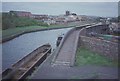
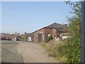
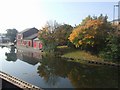
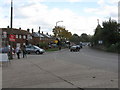
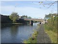
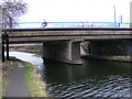
Daily life in DY4 8HU is shaped by its accessible amenities. Residents have five nearby rail stations, including Tipton and Dudley Port, offering regular services to larger urban centres. Retail options are plentiful, with five stores such as Aldi Priory and Co-op Woodsetton providing groceries and household items. The presence of multiple metro stations, like Bradley Lane and Loxdale, adds to the area’s convenience for commuters. While the data does not mention parks or leisure facilities, the proximity to transport hubs suggests a focus on practicality over recreation. The community feel is likely defined by the local shops and stations, which serve as focal points for social interaction. For those who prefer a self-contained lifestyle, the area’s amenities are sufficient for daily needs, though it may lack larger entertainment or cultural venues.
Amenities
Schools
| Rank | School | Type | Entry gender | Ages |
|---|
Explore more schools in this area
Go to Schools tabDemographics
The population of DY4 8HU is predominantly adults aged 30-64, with a median age of 47. This suggests a community of middle-aged residents, many of whom may be in their peak earning years or raising families. Home ownership is strong, with 52% of properties owned by residents, indicating a stable, long-term population. The area is primarily composed of houses, not flats or apartments, which aligns with the demographic profile of older, family-oriented households. The predominant ethnic group is White, reflecting the broader regional composition. There is no specific data on deprivation levels, but the high home ownership rate and low crime score imply a relatively affluent, secure environment. The absence of younger or elderly demographics may mean fewer schools or childcare facilities, though this is not explicitly stated.
Household Size
Accommodation Type
Tenure
Ethnic Group
Religion
Household Composition
Age
Household Deprivation
NS-SEC
Explore more demographic insights in this area
Go to Demographics tabPlanning
Planning Constraints
- Flood RiskPremium
- Ramsar Wetland SitesPremium
- Area of Outstanding Natural BeautyPremium
- Protected Nature ReservePremium
- Protected WoodlandPremium