Area Overview for DY4 7YL
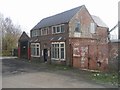
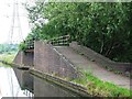
Photos of DY4 7YL


Area Information
DY4 7YL is a small residential cluster in the West Midlands, nestled between Dudley, West Bromwich, and Wednesbury. With a population of 2,344, it reflects a community rooted in industrial heritage yet evolving with modern infrastructure. The area’s name, Great Bridge, hints at its origins—a historic village defined by a gravelly stream crossed by a bridge, likely linked to the Oldbury arm of the River Tame. Today, it balances its past with contemporary amenities, including a 24-hour Asda superstore on a former factory site and the Walsall Canal, which offers a scenic route for pedestrians. The Black Country Spine Road, opened in 1995, ensures quick access to nearby towns and motorways, making it a practical choice for commuters. Daily life here is shaped by proximity to rail stations like Dudley Port and Tipton, as well as local retail hubs such as Lidl and Morrisons. While the area’s factories have largely closed since the late 1990s, its strategic location and ongoing commercial development suggest a pragmatic, forward-looking character. For buyers, DY4 7YL offers a compact, accessible environment with a mix of historical and modern influences.
- Area Type
- Postcode
- Area Size
- Not available
- Population
- 2344
- Population Density
- 4681 people/km²
DY4 7YL’s property market is characterised by a 53% home ownership rate, with houses forming the majority of the housing stock. This suggests a market skewed toward owner-occupation rather than rental, though the small area size may limit the availability of diverse property types. The predominance of houses, as opposed to flats or apartments, indicates a focus on family-friendly or semi-detached living. Given the area’s compact nature, buyers may need to look beyond immediate surroundings for more options, particularly if seeking newer builds or alternative formats. The historical presence of factories and foundries, now largely demolished, has given way to commercial and retail spaces like the Asda superstore, which may influence property values through proximity to amenities. However, the limited scale of DY4 7YL means the market is likely tight, with fewer properties available compared to larger towns. Buyers should consider nearby areas for broader choices, though the area’s connectivity and established infrastructure offer practical advantages for those prioritising convenience over expansive choice.
House Prices in DY4 7YL
No properties found in this postcode.
Energy Efficiency in DY4 7YL
Living in DY4 7YL offers a blend of everyday convenience and historical context. Nearby retail options include Morrisons Daily, Lidl Tipton, and Heron Tipton, providing access to groceries and essentials. The area’s commercial development is evident in the 24-hour Asda superstore, which occupies a former factory site, and the Wilko store in the old village centre, reflecting a mix of old and new. For leisure, the Walsall Canal and River Tame offer scenic walking routes, while the Black Lake and Dudley Street Guns Village provide informal gathering spots. The proximity to rail stations like Sandwell & Dudley and Tipton ensures easy access to larger towns, enhancing the area’s appeal for those who value connectivity. The character of DY4 7YL is pragmatic, with amenities focused on practicality rather than luxury. Residents can enjoy a straightforward lifestyle with minimal need for long commutes, supported by nearby shops, transport, and green spaces. While not a destination for high-end leisure, the area’s accessibility and affordability make it suitable for those prioritising convenience and proximity to essential services.
Amenities
Schools
| Rank | School | Type | Entry gender | Ages |
|---|
Explore more schools in this area
Go to Schools tabDemographics
The population of DY4 7YL is 2,344, with a median age of 47, indicating a mature demographic skewed toward adults aged 30–64. Home ownership stands at 53%, with houses being the predominant accommodation type. This suggests a community of long-term residents, many of whom may have ties to the area’s industrial past. The predominant ethnic group is White, reflecting broader regional trends in the West Midlands. The age profile implies a stable, established population with fewer young families or elderly dependents compared to other areas. While no specific deprivation data is provided, the high home ownership rate and moderate age range suggest a generally secure economic base. However, the absence of detailed diversity metrics means the full scope of the community’s social composition remains less defined. For prospective buyers, this demographic profile points to a steady, low-turnover market with homes likely occupied by individuals or couples in their middle years.
Household Size
Accommodation Type
Tenure
Ethnic Group
Religion
Household Composition
Age
Household Deprivation
NS-SEC
Explore more demographic insights in this area
Go to Demographics tabPlanning
Planning Constraints
- Flood RiskPremium
- Ramsar Wetland SitesPremium
- Area of Outstanding Natural BeautyPremium
- Protected Nature ReservePremium
- Protected WoodlandPremium