Area Overview for DY4 7TG
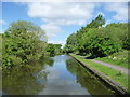
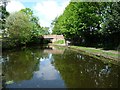
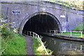
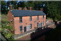
Photos of DY4 7TG


Area Information
Living in DY4 7TG means inhabiting a tightly packed residential cluster in the West Midlands, where 2,352 people reside across just 2,357 square metres. This density creates a compact, community-oriented environment, typical of areas shaped by historical industrial activity. The postcode sits within Sandwell, a borough with roots in Oldbury’s 19th-century development as a market town. Daily life here is defined by proximity to retail, transport, and green spaces, though the area’s small size means amenities are concentrated. The population skews toward adults aged 30–64, with a median age of 47, suggesting a mature, stable community. While the area lacks sprawling landscapes, its proximity to Dudley and Tipton offers access to broader urban amenities. For those prioritising convenience over space, DY4 7TG’s high density and transport links make it a practical choice, though its limited size means every decision about living here is shaped by proximity and shared resources.
- Area Type
- Postcode
- Area Size
- 2357 m²
- Population
- 2352
- Population Density
- 5917 people/km²
The property market in DY4 7TG is characterised by a 48% home ownership rate, with houses making up the majority of accommodation types. This suggests a focus on family homes rather than apartments or flats, aligning with the area’s mature demographic. The relatively low home ownership percentage indicates a significant rental market, which could affect property values and availability. Given the postcode’s small size—just 2,357 square metres—the housing stock is likely limited, making competition for properties intense. Buyers should consider that the area’s compact nature means proximity to amenities is a priority, but expansion is constrained. For those seeking a home, the emphasis on houses may appeal to families, though the high population density could mean limited space for larger properties. The market’s dynamics are shaped by its role as a small, connected hub within Sandwell, balancing practicality with the challenges of limited land.
House Prices in DY4 7TG
Showing 9 properties
| Address | Type | Beds | Baths | Last Sale Price | Last Sale Date | |
|---|---|---|---|---|---|---|
| 93 Tividale Road, Tipton, DY4 7TG | house | - | - | £210,000 | Oct 2022 | |
| 115 Tividale Road, Tipton, DY4 7TG | Terraced | 2 | 1 | £135,000 | Jul 2004 | |
| 97 Tividale Road, Tipton, DY4 7TG | Semi-detached | 3 | 1 | - | - | |
| 95 Tividale Road, Tipton, DY4 7TG | house | - | - | - | - | |
| 105 Tividale Road, Tipton, DY4 7TG | Flat | - | - | - | - | |
| 99 Tividale Road, Tipton, DY4 7TG | Flat | - | - | - | - | |
| 91 Tividale Road, Tipton, DY4 7TG | house | - | - | - | - | |
| 101 Tividale Road, Tipton, DY4 7TG | Flat | - | - | - | - | |
| 103 Tividale Road, Tipton, DY4 7TG | Flat | - | - | - | - |
Energy Efficiency in DY4 7TG
Life in DY4 7TG revolves around its proximity to essential amenities. Retail options include Co-op Tipton, Tesco Dudley, and Morrisons Daily, providing convenient access to groceries and household goods. The area’s transport links—five rail stations and five metro stops—mean residents can reach Dudley, Birmingham, and surrounding towns quickly, supporting both daily errands and longer commutes. While the data does not list parks or leisure facilities directly, the area’s historical roots in Oldbury suggest nearby green spaces, though specifics are not provided. The compact nature of DY4 7TG means amenities are concentrated, reducing travel time but also limiting options. For those prioritising convenience over variety, this setup is efficient, though it may require planning for more specialised needs. The mix of retail, transport, and community-focused infrastructure creates a practical, if modest, lifestyle.
Amenities
Schools
| Rank | School | Type | Entry gender | Ages |
|---|
Explore more schools in this area
Go to Schools tabDemographics
DY4 7TG’s population is predominantly adults aged 30–64, with a median age of 47, reflecting a mature demographic. Home ownership here stands at 48%, slightly below the national average, indicating a mix of owner-occupied and rental properties. The area’s accommodation is largely houses, suggesting a focus on family homes rather than flats or apartments. The predominant ethnic group is White, though specific data on diversity is not provided. The high population density—997,905 people per square kilometre—means residents live closely together, which can foster a tight-knit community but may also strain shared resources. With 48% of homes owned outright, the area leans toward stability, though the lower ownership rate could imply a reliance on rental markets. The age profile suggests a community with established careers and families, which may influence local services and amenities.
Household Size
Accommodation Type
Tenure
Ethnic Group
Religion
Household Composition
Age
Household Deprivation
NS-SEC
Explore more demographic insights in this area
Go to Demographics tabPlanning
Planning Constraints
- Flood RiskPremium
- Ramsar Wetland SitesPremium
- Area of Outstanding Natural BeautyPremium
- Protected Nature ReservePremium
- Protected WoodlandPremium