Area Overview for DY4 7TB
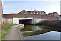
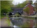
Photos of DY4 7TB


Area Information
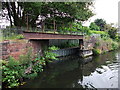
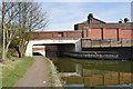
DY4 7TB is a small, densely populated postcode area in England, encompassing a residential cluster with a population of 1767 across 5698 square metres. Its compact size and high population density of 310,123 people per square kilometre suggest a tightly knit community, though the area’s character is shaped by its historical roots in the West Midlands. Research indicates the region is part of Oldbury, a town with a long industrial heritage, including ironworks and canals from the 18th century. While the area lacks major landmarks, its proximity to Dudley and Tipton offers access to broader urban amenities. Daily life here is likely influenced by the surrounding infrastructure, with nearby rail stations and retail outlets providing convenience. The demographic profile—predominantly adults aged 30–64—suggests a mature population, possibly drawn to the area for established housing and local services. However, the small size of DY4 7TB means its immediate surroundings define much of its character, with limited scope for expansion or new developments.
- Area Type
- Postcode
- Area Size
- 5698 m²
- Population
- 1767
- Population Density
- 3482 people/km²
The property market in DY4 7TB is characterised by a 42% home ownership rate, suggesting that nearly half of properties are rented. The accommodation type is predominantly houses, which may indicate a preference for single-family dwellings over flats or apartments. This mix of ownership and rental properties could appeal to buyers seeking long-term stability or investors targeting the local housing stock. However, the small area size—just 5698 square metres—means the market is limited in scope, with little room for new developments. Buyers should consider the proximity to nearby towns like Dudley and Tipton, where additional amenities and services are available. The lack of specific data on property prices or trends means potential buyers must rely on local real estate agents for up-to-date market insights.
House Prices in DY4 7TB
Showing 15 properties
| Address | Type | Beds | Baths | Last Sale Price | Last Sale Date | |
|---|---|---|---|---|---|---|
| 35 Groveland Road, Tipton, DY4 7TB | Flat | - | - | £100,000 | Dec 2024 | |
| 37 Groveland Road, Tipton, DY4 7TB | Flat | 2 | 1 | £95,000 | Oct 2022 | |
| 33 Groveland Road, Tipton, DY4 7TB | Flat | 2 | 1 | £91,500 | Jul 2022 | |
| 55 Groveland Road, Tipton, DY4 7TB | Flat | - | - | £95,000 | May 2022 | |
| 39 Groveland Road, Tipton, DY4 7TB | Flat | - | - | £81,500 | Nov 2017 | |
| 51 Groveland Road, Tipton, DY4 7TB | Flat | - | - | £70,000 | Nov 2017 | |
| 45 Groveland Road, Tipton, DY4 7TB | Flat | - | - | £45,000 | Jan 2016 | |
| 49 Groveland Road, Tipton, DY4 7TB | Maisonette | - | - | £30,000 | Dec 2014 | |
| 43 Groveland Road, Tipton, DY4 7TB | Flat | - | - | £60,000 | Nov 2014 | |
| 59 Groveland Road, Tipton, DY4 7TB | Flat | 2 | 1 | £70,000 | Apr 2014 |
Energy Efficiency in DY4 7TB
Residents of DY4 7TB have access to a range of nearby amenities within practical reach. The retail sector includes major stores like Morrisons Daily, Co-op Tipton, and Tesco Dudley, providing everyday shopping convenience. For transport, five rail stations—such as Dudley Port and Sandwell & Dudley—offer links to broader networks, while five metro stops, including Black Lake and Dartmouth Street, provide local mobility. The area’s compact size means these amenities are likely within walking or short driving distance. While specific parks or leisure facilities are not detailed in the data, the proximity to larger towns suggests access to recreational spaces and community centres. The mix of retail, transport, and nearby urban hubs contributes to a functional lifestyle, though the area’s small size may limit the diversity of on-site amenities.
Amenities
Schools
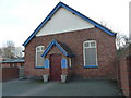
The nearest school to DY4 7TB is Sacred Heart Primary School, a primary school with a good Ofsted rating. This suggests a reliable educational option for families in the area, though no secondary schools are listed in the data. The presence of a primary school with a positive rating may be a key factor for parents prioritising local education. However, the absence of secondary school information means families may need to look further afield for comprehensive schooling. The school’s good rating indicates it meets national standards, but the lack of additional educational facilities in the immediate vicinity could be a consideration for those requiring a full range of schooling options.
| Rank | School | Type | Entry gender | Ages |
|---|
Explore more schools in this area
Go to Schools tabDemographics
The community in DY4 7TB is predominantly composed of adults aged 30–64, with a median age of 47. This suggests a mature population, likely with long-term ties to the area. Home ownership is relatively low at 42%, indicating a mix of owner-occupied and rented properties. The accommodation type is primarily houses, which may reflect the area’s historical development as a residential cluster. The predominant ethnic group is White, though no specific data on diversity or deprivation levels is provided. The age profile implies a stable, possibly family-oriented demographic, though the absence of data on younger or older residents means the full picture of the community’s needs remains unclear. The lack of specific figures on deprivation or income levels means it is difficult to assess how economic factors might influence quality of life here.
Household Size
Accommodation Type
Tenure
Ethnic Group
Religion
Household Composition
Age
Household Deprivation
NS-SEC
Explore more demographic insights in this area
Go to Demographics tabPlanning
Planning Constraints
- Flood RiskPremium
- Ramsar Wetland SitesPremium
- Area of Outstanding Natural BeautyPremium
- Protected Nature ReservePremium
- Protected WoodlandPremium