Area Overview for DY4 7PG
Photos of DY4 7PG
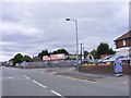
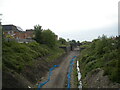
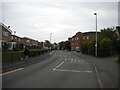
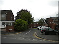
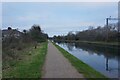
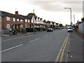
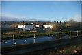
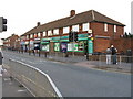
22 photos from this area
Area Information
Key information about the DY4 7PG including its size, population, and administrative classification.
- Area Type
- Postcode
- Area Size
- 2.0 hectares
- Population
- 1547
- Population Density
- 5271 people/km²
House Prices in DY4 7PG
19
Properties
£193,528
Average Sold Price
£60,000
Lowest Price
£295,000
Highest Price
Showing 19 properties
| Address | Type | Beds | Baths | Last Sale Price | Last Sale Date | |
|---|---|---|---|---|---|---|
| 56 Lower Church Lane, Tipton, DY4 7PG | house | - | - | £265,000 | Aug 2023 | |
| 53 Lower Church Lane, Tipton, DY4 7PG | house | - | - | £236,000 | Sep 2022 | |
| 49 Lower Church Lane, Tipton, DY4 7PG | Detached | 4 | 1 | £295,000 | Jun 2021 | |
| 51 Lower Church Lane, Tipton, DY4 7PG | Semi-detached | 3 | - | £181,000 | Apr 2021 | |
| 55 Lower Church Lane, Tipton, DY4 7PG | Semi-detached | 3 | - | £160,000 | Aug 2016 | |
| 54 Lower Church Lane, Tipton, DY4 7PG | Semi-detached | 3 | - | £160,000 | Jun 2016 | |
| 52 Lower Church Lane, Tipton, DY4 7PG | house | - | - | £160,000 | Mar 2015 | |
| 50 Lower Church Lane, Tipton, DY4 7PG | house | - | - | £224,750 | Jan 2015 | |
| 35 Lower Church Lane, Tipton, DY4 7PG | Detached | - | - | £60,000 | Sep 1999 | |
| 43 Lower Church Lane, Tipton, DY4 7PG | Detached | 3 | 2 | - | - |
Page 1 of 2
Energy Efficiency in DY4 7PG
Amenities
Schools
| Rank | School | Type | Entry gender | Ages |
|---|
Explore more schools in this area
Go to Schools tabDemographics
Household Size
Family (3-5 people)
most common
Accommodation Type
Houses
most common
Tenure
77
majority
Ethnic Group
White
most common
Religion
N/A
most common
Household Composition
N/A
most common
Age
47
median
Adults (30-64 years)
most common
Household Deprivation
N/A
with no deprivation
NS-SEC
25
in Lower managerial occupations
Explore more demographic insights in this area
Go to Demographics tabPlanning
Planning Constraints
- Flood RiskPremium
- Ramsar Wetland SitesPremium
- Area of Outstanding Natural BeautyPremium
- Protected Nature ReservePremium
- Protected WoodlandPremium