Area Overview for DY3 4LD
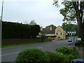
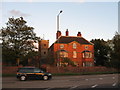
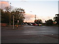
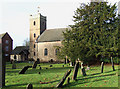
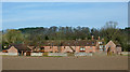
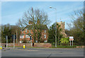
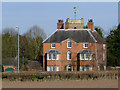
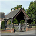
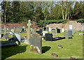
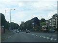
Photos of DY3 4LD

Area Information
DY3 4LD is a small, tightly knit residential area in England, covering just 4.2 hectares and home to 2,523 people. Its compact size means it feels intimate, with a population density of 150 people per square kilometre. This postcode area is characterised by a mix of older and newer housing, with a strong emphasis on owner-occupied homes. The community here is predominantly middle-aged, with a median age of 47, and many residents are in their 30s to 60s. Daily life is shaped by proximity to local amenities, including five retail outlets, multiple train stations, and a nearby airport. While the area is not large, its strategic location offers access to transport networks and essential services. For those seeking a quiet, residential environment with practical connectivity, DY3 4LD provides a balance of convenience and community. However, buyers should note the area’s challenges, including a high flood risk and moderate crime levels, which are addressed in more detail later.
- Area Type
- Postcode
- Area Size
- 4.2 hectares
- Population
- 2523
- Population Density
- 150 people/km²
DY3 4LD is primarily an owner-occupied area, with 78% of homes owned by residents rather than rented. This reflects a community of long-term residents who have invested in property. The accommodation type is predominantly houses, which is unusual for a small postcode area but suggests a mix of semi-detached and detached homes. The compact size of the area means that property choices are limited to the immediate vicinity, with no indication of large-scale developments. For buyers, this implies a market where properties are likely to be in private hands, with limited rental availability. The focus on houses rather than flats may appeal to those seeking more space or a traditional suburban feel. However, the small area size means that buyers should consider proximity to nearby towns for additional options. The high home ownership rate also indicates a stable market, with fewer speculative investments.
House Prices in DY3 4LD
Showing 1 properties
| Address | Type | Beds | Baths | Last Sale Price | Last Sale Date | |
|---|---|---|---|---|---|---|
| Managers Accommodation, Himley House Hotel, Wolverhampton Road, Himley, DY3 4LD | Flat | - | - | - | - |
Energy Efficiency in DY3 4LD
Living in DY3 4LD offers access to a range of local amenities within practical reach. The area includes five retail outlets, such as Co-op Wall, Morrisons Kingswinford, and Morrisons Daily Wombourne, providing everyday shopping options. Residents can also reach Wolverhampton Halfpenny Green Airport for travel. The rail network is particularly strong, with five stations—including Coseley, Stourbridge Town, and Tipton—offering connections to nearby towns and cities. Metro services at Priestfield, Royal, and Wolverhampton St George’s further enhance mobility. While the area is small, these amenities contribute to a convenient lifestyle, balancing local convenience with regional accessibility. The presence of multiple transport options and retail choices suggests that daily needs can be met without long commutes. However, the area’s compact size means that more specialised services may require travel to larger centres.
Amenities
Schools
The nearest school to DY3 4LD is St John’s CofE (C) Primary School, which provides education for younger children. This school is rated ‘good’ by Ofsted, indicating a solid standard of teaching and facilities. As a primary school, it serves the immediate community, offering a local option for families with young children. The absence of secondary schools in the data suggests that students may need to travel to nearby towns for higher education. The presence of a ‘good’ rated primary school is a positive factor for families prioritising quality education. However, the limited range of schools means that buyers should investigate further if they require a full range of educational options. The school’s rating and proximity make it a key consideration for those evaluating DY3 4LD as a family-friendly area.
| Rank | School | Type | Entry gender | Ages |
|---|
Explore more schools in this area
Go to Schools tabDemographics
The population of DY3 4LD is 2,523, with a median age of 47, indicating a mature demographic. The most common age range is 30–64, suggesting a community of established professionals and families. Home ownership is high at 78%, reflecting a stable, long-term resident base. The area is predominantly composed of houses rather than flats, which is typical of smaller residential clusters. The predominant ethnic group is White, and while specific diversity data is not provided, the absence of notable minority groups is implied by the data. The age profile and ownership figures suggest a low turnover of residents, with many families settling in for the long term. The population density of 150 people per square kilometre is moderate, ensuring a balance between privacy and community interaction. This demographic profile shapes the area’s character, with a focus on family-oriented living and stable, owner-occupied homes.
Household Size
Accommodation Type
Tenure
Ethnic Group
Religion
Household Composition
Age
Household Deprivation
NS-SEC
Explore more demographic insights in this area
Go to Demographics tabPlanning
Planning Constraints
- Flood RiskPremium
- Ramsar Wetland SitesPremium
- Area of Outstanding Natural BeautyPremium
- Protected Nature ReservePremium
- Protected WoodlandPremium