Area Overview for DY3 4HB
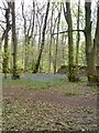
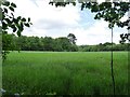
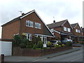
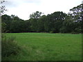
Photos of DY3 4HB

Area Information
DY3 4HB is a small residential cluster in England, spanning 53.4 hectares and home to 2,523 residents. Its compact size fosters a tight-knit community feel, with a population density of 150 people per square kilometre. The area’s demographic profile suggests a mature, stable population, with a median age of 47 and a majority of residents aged between 30 and 64. This suggests a mix of long-term residents and families, with 78% owning their homes. The predominance of houses over flats indicates a suburban character, distinct from denser urban areas. Living here offers proximity to essential services, including rail links to Wolverhampton and Tipton, and access to a primary school with a good Ofsted rating. While the area is not expansive, its manageable scale means residents can easily navigate local amenities and community hubs. The low flood risk and absence of protected natural sites suggest a relatively straightforward planning environment, though buyers should note the presence of protected woodland nearby. For those seeking a quiet, family-oriented setting with practical connectivity, DY3 4HB balances residential comfort with strategic location.
- Area Type
- Postcode
- Area Size
- 53.4 hectares
- Population
- 2523
- Population Density
- 150 people/km²
DY3 4HB is predominantly an owner-occupied area, with 78% of homes owned by residents rather than rented. The housing stock consists largely of houses, which is typical for a suburban postcode of this size. This suggests a market that prioritises private ownership over rental properties, potentially offering buyers a stable environment with less turnover. The limited area size means the housing stock is constrained, which could lead to competition among buyers, particularly for larger properties. The presence of houses rather than flats indicates a preference for space and privacy, appealing to families or individuals seeking a settled lifestyle. However, the small scale of the area may mean that property choices are limited to existing stock, with fewer new developments. Buyers should consider the proximity to transport links and amenities when evaluating properties, as these are critical factors in the area’s appeal.
House Prices in DY3 4HB
Showing 1 properties
| Address | Type | Beds | Baths | Last Sale Price | Last Sale Date | |
|---|---|---|---|---|---|---|
| Freedom Catering, Catering Facility, Baggeridge Country Park, Fir Street, Gospel End, DY3 4HB | Restaurant | - | - | - | - |
Energy Efficiency in DY3 4HB
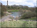
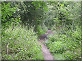
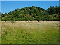
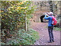
DY3 4HB offers a practical lifestyle with access to essential amenities. Local shops include Spar, Co-op Wombourne, and Iceland Sedgley, providing convenience for daily shopping. The nearby rail stations and metro links ensure easy travel to Wolverhampton and surrounding areas, while the proximity to Wolverhampton Halfpenny Green Airport adds flexibility for regional travel. The area’s small size means residents can reach these amenities without long commutes, contributing to a balanced lifestyle. The presence of a primary school with a good Ofsted rating supports family life, and the surrounding environment, while not heavily wooded, includes protected woodland that may offer recreational opportunities. The mix of retail, transport, and green spaces creates a functional, community-oriented setting. While the area lacks large-scale leisure facilities, its proximity to nearby towns compensates by offering broader options.
Amenities
Schools
The primary school nearest to DY3 4HB is St John’s CofE (C) Primary School, which holds a ‘good’ Ofsted rating. This school serves the local community, offering education for younger children and providing a foundation for families considering the area. The absence of secondary schools in the immediate vicinity means that parents may need to look further afield for secondary education, though the nearby rail network facilitates travel to larger towns. The presence of a well-rated primary school is a significant draw for families, as it ensures access to quality early education. The school’s ‘good’ rating suggests a competent teaching staff and adequate resources, which can be a deciding factor for homebuyers prioritising educational opportunities. While the area’s school mix is limited to primary education, the quality of the existing school supports the appeal of DY3 4HB for families.
| Rank | School | Type | Entry gender | Ages |
|---|
Explore more schools in this area
Go to Schools tabDemographics
The community in DY3 4HB is predominantly composed of adults aged 30 to 64, with a median age of 47. This suggests a mature population, likely with established careers and families. Home ownership is high, at 78%, indicating a stable housing market with a focus on long-term residency. The area is characterised by houses rather than flats, which aligns with the suburban nature of the postcode. The predominant ethnic group is White, reflecting a homogenous demographic profile. While specific data on deprivation is not provided, the high home ownership rate and moderate population density suggest a community with reasonable access to services and employment. The age distribution implies a balance between active professionals and retirees, though the absence of younger residents may influence local amenities and school demand. The area’s demographic makeup is likely to shape its social dynamics, with a focus on family life and community cohesion.
Household Size
Accommodation Type
Tenure
Ethnic Group
Religion
Household Composition
Age
Household Deprivation
NS-SEC
Explore more demographic insights in this area
Go to Demographics tabPlanning
Planning Constraints
- Flood RiskPremium
- Ramsar Wetland SitesPremium
- Area of Outstanding Natural BeautyPremium
- Protected Nature ReservePremium
- Protected WoodlandPremium