Area Overview for DY3 2TG
Photos of DY3 2TG
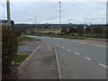
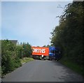
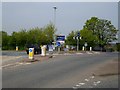
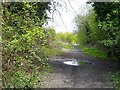
50 photos from this area
Area Information
Key information about the DY3 2TG including its size, population, and administrative classification.
- Area Type
- Postcode
- Area Size
- 1.1 hectares
- Population
- 1412
- Population Density
- 5002 people/km²
House Prices in DY3 2TG
22
Properties
£140,063
Average Sold Price
£15,000
Lowest Price
£236,000
Highest Price
Showing 22 properties
| Address | Type | Beds | Baths | Last Sale Price | Last Sale Date | |
|---|---|---|---|---|---|---|
| 28 Summit Place, Lower Gornal, DY3 2TG | Terraced | 2 | 1 | £200,000 | Feb 2023 | |
| 2 Summit Place, Lower Gornal, DY3 2TG | Detached | 3 | 2 | £236,000 | Sep 2021 | |
| 6 Summit Place, Lower Gornal, DY3 2TG | Detached | 4 | 1 | £175,500 | Aug 2015 | |
| 26 Summit Place, Lower Gornal, DY3 2TG | Semi-detached | - | - | £156,000 | Mar 2010 | |
| 18 Summit Place, Lower Gornal, DY3 2TG | Semi-detached | - | - | £146,000 | Sep 2005 | |
| 34 Summit Place, Lower Gornal, DY3 2TG | house | - | - | £15,000 | Dec 2000 | |
| 14 Summit Place, Lower Gornal, DY3 2TG | house | - | - | £126,000 | Jun 1999 | |
| 22 Summit Place, Lower Gornal, DY3 2TG | Semi-detached | - | - | £66,000 | Oct 1997 | |
| 20 Summit Place, Lower Gornal, DY3 2TG | Detached | 3 | 1 | - | - | |
| 4 Summit Place, Lower Gornal, DY3 2TG | house | - | - | - | - |
Page 1 of 3
Energy Efficiency in DY3 2TG
Amenities
Schools
| Rank | School | Type | Entry gender | Ages |
|---|
Explore more schools in this area
Go to Schools tabDemographics
Household Size
One person
most common
Accommodation Type
Houses
most common
Tenure
67
majority
Ethnic Group
White
most common
Religion
N/A
most common
Household Composition
N/A
most common
Age
47
median
Adults (30-64 years)
most common
Household Deprivation
N/A
with no deprivation
NS-SEC
25
in Lower managerial occupations
Explore more demographic insights in this area
Go to Demographics tabPlanning
Planning Constraints
- Flood RiskPremium
- Ramsar Wetland SitesPremium
- Area of Outstanding Natural BeautyPremium
- Protected Nature ReservePremium
- Protected WoodlandPremium