Area Overview for DY3 1WU
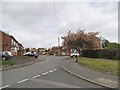
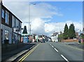
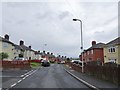
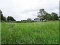
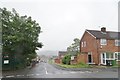
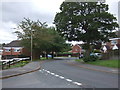
Photos of DY3 1WU


Area Information
DY3 1WU is a small residential postcode in England, home to around 1,600 people. It is a compact area where houses dominate the housing stock, reflecting a community of settled families and individuals. The median age of 47 suggests a mature population, with most residents falling within the 30-64 age range. Daily life here is shaped by proximity to essential services, including five retail outlets such as Tesco Gornal and Morrisons Daily Dudley, and multiple rail and metro stations. The area’s connectivity is strong, with broadband quality rated excellent and mobile coverage good, supporting both work and leisure. While the postcode does not overlap with protected natural areas, it is served by practical transport links, including Wolverhampton Halfpenny Green Airport. This makes DY3 1WU a convenient location for those balancing local amenities with access to regional infrastructure. The small population and residential focus create a quiet, community-oriented environment, though the area’s size means it is best suited for buyers prioritising proximity to services over expansive space.
- Area Type
- Postcode
- Area Size
- Not available
- Population
- 1602
- Population Density
- 5468 people/km²
The property market in DY3 1WU is characterised by a high proportion of owner-occupied homes, with 57% of properties owned by residents. This suggests a community of long-term residents rather than a transient rental market. The accommodation type is predominantly houses, which are likely family homes given the area’s median age and age range. The small postcode area means the housing stock is limited, and buyers should consider nearby regions for more options. The presence of multiple rail and metro stations indicates the area is well-connected to surrounding towns, which may influence property values. However, the lack of major planning constraints or environmental restrictions means development pressure is low. For buyers, this means a focus on existing homes rather than new builds, with potential for stable long-term investment. The market’s modest size and residential focus make it ideal for those seeking a settled, community-oriented location.
House Prices in DY3 1WU
No properties found in this postcode.
Energy Efficiency in DY3 1WU
Living in DY3 1WU offers access to a range of practical amenities within walking or short driving distance. Retail options include major chains like Tesco Gornal, Morrisons Daily Dudley, and Co-op Dibdale, ensuring everyday shopping needs are met. The area’s rail and metro stations—Coseley, Tipton, and Dudley Port—provide easy access to public transport, while nearby metro stops such as Loxdale and Bradley Lane connect to broader networks. The proximity to Wolverhampton Halfpenny Green Airport adds convenience for regional travel. While the area lacks large-scale leisure facilities, the density of retail and transport hubs suggests a functional, service-oriented lifestyle. The small population and residential focus mean the community is close-knit, with amenities tailored to daily practicality rather than luxury. This makes DY3 1WU ideal for those prioritising convenience and connectivity over sprawling urban or rural settings.
Amenities
Schools
| Rank | School | Type | Entry gender | Ages |
|---|
Explore more schools in this area
Go to Schools tabDemographics
The population of DY3 1WU is 1,602, with a median age of 47, indicating a community of middle-aged adults. The majority of residents fall within the 30-64 age range, suggesting a stable demographic with strong family presence. Home ownership stands at 57%, meaning nearly half the properties are owner-occupied, while the remainder are likely rentals. The accommodation type is predominantly houses, which aligns with the area’s residential character. The predominant ethnic group is White, reflecting a homogenous population. While no specific data on deprivation is provided, the high home ownership rate and mature age profile may suggest a relatively stable economic environment. However, the absence of detailed diversity metrics means the community’s full composition remains less defined. The area’s small size and focused demographics create a tight-knit environment, though it may lack the diversity seen in larger urban centres.
Household Size
Accommodation Type
Tenure
Ethnic Group
Religion
Household Composition
Age
Household Deprivation
NS-SEC
Explore more demographic insights in this area
Go to Demographics tabPlanning
Planning Constraints
- Flood RiskPremium
- Ramsar Wetland SitesPremium
- Area of Outstanding Natural BeautyPremium
- Protected Nature ReservePremium
- Protected WoodlandPremium