Area Overview for DY3 1TG
Photos of DY3 1TG
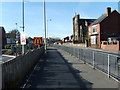
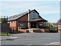
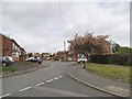
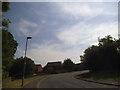
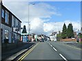
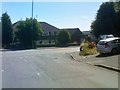
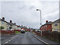
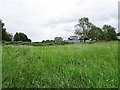
100 photos from this area
Area Information
Key information about the DY3 1TG including its size, population, and administrative classification.
- Area Type
- Postcode
- Area Size
- 1.4 hectares
- Population
- 1283
- Population Density
- 5566 people/km²
House Prices in DY3 1TG
36
Properties
£152,392
Average Sold Price
£46,000
Lowest Price
£370,500
Highest Price
Showing 36 properties
| Address | Type | Beds | Baths | Last Sale Price | Last Sale Date | |
|---|---|---|---|---|---|---|
| Zyphers, 25 Arcal Street, Sedgley, DY3 1TG | Detached | 3 | 2 | £370,500 | Feb 2023 | |
| 22 Arcal Street, Sedgley, DY3 1TG | Bungalow | 2 | 1 | £223,000 | Feb 2022 | |
| 33 Arcal Street, Sedgley, DY3 1TG | Detached | 3 | 1 | £207,500 | Nov 2020 | |
| 24 Arcal Street, Sedgley, DY3 1TG | Detached | 3 | - | £232,250 | Mar 2020 | |
| 29 Arcal Street, Sedgley, DY3 1TG | Terraced | 2 | 1 | £156,000 | Dec 2019 | |
| 28 Arcal Street, Sedgley, DY3 1TG | house | - | - | £96,500 | Dec 2012 | |
| 31 Arcal Street, Sedgley, DY3 1TG | house | 2 | - | £93,500 | Mar 2012 | |
| 14B Arcal Street, Sedgley, DY3 1TG | Semi-detached | - | - | £69,500 | Jan 2007 | |
| 30 Arcal Street, Sedgley, DY3 1TG | Terraced | - | - | £125,000 | Mar 2006 | |
| 14A Arcal Street, Sedgley, DY3 1TG | Semi-detached | 2 | 1 | £92,000 | Apr 2003 |
Page 1 of 4
Energy Efficiency in DY3 1TG
Amenities
Schools
| Rank | School | Type | Entry gender | Ages |
|---|
Explore more schools in this area
Go to Schools tabDemographics
Household Size
Family (3-5 people)
most common
Accommodation Type
Houses
most common
Tenure
48
majority
Ethnic Group
White
most common
Religion
N/A
most common
Household Composition
N/A
most common
Age
47
median
Adults (30-64 years)
most common
Household Deprivation
N/A
with no deprivation
NS-SEC
22
in Lower managerial occupations
Explore more demographic insights in this area
Go to Demographics tabPlanning
Planning Constraints
- Flood RiskPremium
- Ramsar Wetland SitesPremium
- Area of Outstanding Natural BeautyPremium
- Protected Nature ReservePremium
- Protected WoodlandPremium