Area Overview for DY3 1NU
Photos of DY3 1NU
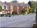
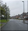
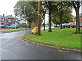
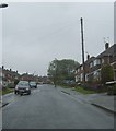
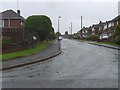
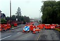
100 photos from this area
Area Information
Key information about the DY3 1NU including its size, population, and administrative classification.
- Area Type
- Postcode
- Area Size
- 7252 m²
- Population
- 1536
- Population Density
- 4751 people/km²
House Prices in DY3 1NU
12
Properties
£114,400
Average Sold Price
£55,000
Lowest Price
£190,000
Highest Price
Showing 12 properties
| Address | Type | Beds | Baths | Last Sale Price | Last Sale Date | |
|---|---|---|---|---|---|---|
| 22 Castle Street, Sedgley, DY3 1NU | house | - | - | £190,000 | Sep 2021 | |
| 27 Castle Street, Sedgley, DY3 1NU | house | 3 | - | £123,500 | Dec 2015 | |
| 19 Castle Street, Sedgley, DY3 1NU | Terraced | 3 | 1 | £99,000 | May 2015 | |
| 18 Castle Street, Sedgley, DY3 1NU | Semi-detached | - | - | £100,000 | Jun 2011 | |
| 16 Castle Street, Sedgley, DY3 1NU | house | - | - | £142,500 | Aug 2010 | |
| 21 Castle Street, Sedgley, DY3 1NU | Terraced | 3 | 1 | £112,500 | Jul 2009 | |
| 20 Castle Street, Sedgley, DY3 1NU | house | - | - | £115,000 | Jun 2007 | |
| 17 Castle Street, Sedgley, DY3 1NU | Semi-detached | 2 | 1 | £119,000 | Dec 2004 | |
| 13 Castle Street, Sedgley, DY3 1NU | Terraced | - | - | £87,500 | Apr 2004 | |
| 25 Castle Street, Sedgley, DY3 1NU | Terraced | 3 | 1 | £55,000 | Jul 2001 |
Page 1 of 2
Energy Efficiency in DY3 1NU
Amenities
Schools
| Rank | School | Type | Entry gender | Ages |
|---|
Explore more schools in this area
Go to Schools tabDemographics
Household Size
One person
most common
Accommodation Type
Houses
most common
Tenure
58
majority
Ethnic Group
White
most common
Religion
N/A
most common
Household Composition
N/A
most common
Age
47
median
Adults (30-64 years)
most common
Household Deprivation
N/A
with no deprivation
NS-SEC
23
in Lower managerial occupations
Explore more demographic insights in this area
Go to Demographics tabPlanning
Planning Constraints
- Flood RiskPremium
- Ramsar Wetland SitesPremium
- Area of Outstanding Natural BeautyPremium
- Protected Nature ReservePremium
- Protected WoodlandPremium