Area Overview for DY3 1JA
Photos of DY3 1JA
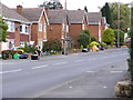
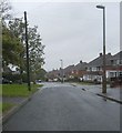
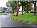
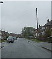
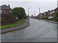
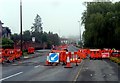
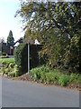
100 photos from this area
Area Information
Key information about the DY3 1JA including its size, population, and administrative classification.
- Area Type
- Postcode
- Area Size
- 1.2 hectares
- Population
- 1536
- Population Density
- 4751 people/km²
House Prices in DY3 1JA
35
Properties
£158,027
Average Sold Price
£49,500
Lowest Price
£280,000
Highest Price
Showing 35 properties
| Address | Type | Beds | Baths | Last Sale Price | Last Sale Date | |
|---|---|---|---|---|---|---|
| 65 Bilston Street, Sedgley, DY3 1JA | Semi-detached | 2 | 1 | £225,000 | Oct 2025 | |
| 73 Bilston Street, Sedgley, DY3 1JA | Semi-detached | 3 | 1 | £280,000 | Mar 2025 | |
| 71 Bilston Street, Sedgley, DY3 1JA | house | - | - | £259,000 | Jul 2022 | |
| 63 Bilston Street, Sedgley, DY3 1JA | house | - | - | £134,000 | Feb 2021 | |
| 75 Bilston Street, Sedgley, DY3 1JA | house | - | - | £215,500 | Nov 2018 | |
| 53 Bilston Street, Sedgley, DY3 1JA | house | - | - | £190,000 | Nov 2016 | |
| 33 Bilston Street, Sedgley, DY3 1JA | Detached | 3 | 1 | £125,000 | Jan 2015 | |
| 81 Bilston Street, Sedgley, DY3 1JA | Detached | 4 | 1 | £162,500 | Sep 2014 | |
| 61 Bilston Street, Sedgley, DY3 1JA | house | - | - | £110,000 | Jul 2012 | |
| 83 Bilston Street, Sedgley, DY3 1JA | Semi-detached | - | - | £129,950 | Jan 2007 |
Page 1 of 4
Energy Efficiency in DY3 1JA
Amenities
Schools
| Rank | School | Type | Entry gender | Ages |
|---|
Explore more schools in this area
Go to Schools tabDemographics
Household Size
One person
most common
Accommodation Type
Houses
most common
Tenure
58
majority
Ethnic Group
White
most common
Religion
N/A
most common
Household Composition
N/A
most common
Age
47
median
Adults (30-64 years)
most common
Household Deprivation
N/A
with no deprivation
NS-SEC
23
in Lower managerial occupations
Explore more demographic insights in this area
Go to Demographics tabPlanning
Planning Constraints
- Flood RiskPremium
- Ramsar Wetland SitesPremium
- Area of Outstanding Natural BeautyPremium
- Protected Nature ReservePremium
- Protected WoodlandPremium