Area Overview for DY3 1GN
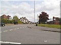
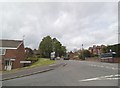
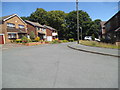
Photos of DY3 1GN


Area Information
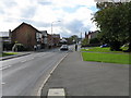
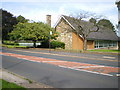
DY3 1GN is a small, tightly knit residential area in England, home to 1,536 residents. Its compact size means it’s a quiet, low-density cluster of homes, primarily occupied by adults aged 30-64, with a median age of 47. This suggests a community of established professionals and families, likely drawn to the area’s practical amenities and proximity to transport links. The postcode is served by five retail outlets, including Asda Sedgley and Aldi Bilston Street, offering everyday convenience. Nearby railway stations—Coseley, Tipton, and Dudley Port—connect residents to broader networks, while metro stops like Priestfield and Bilston Central provide additional mobility. Despite its small footprint, DY3 1GN balances suburban calm with accessible urban connectivity. The area’s broadband score of 98—excellent—ensures reliable internet for remote work or entertainment, though mobile coverage is good but not exceptional. This mix of features makes it a practical choice for those prioritising stability, convenience, and proximity to essential services.
- Area Type
- Postcode
- Area Size
- Not available
- Population
- 1536
- Population Density
- 4751 people/km²
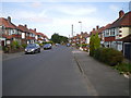
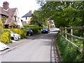
DY3 1GN is primarily an owner-occupied area, with 58% of homes owned by residents. The housing stock consists largely of houses, reflecting a preference for detached or semi-detached properties over flats. This makes the area appealing to families and professionals seeking space and privacy. However, the small size of the postcode means the housing market is limited to a handful of properties, likely concentrated in the immediate vicinity. Buyers should consider the proximity to transport links, such as nearby railway stations and metro stops, which enhance the area’s appeal for commuters. The dominance of owner-occupied homes suggests a stable market with fewer rental options, though the lack of detailed data on property prices or availability means potential buyers should investigate local listings closely. The focus on houses also implies a need for larger gardens or outdoor space, which may be a consideration for those prioritising specific property features.
House Prices in DY3 1GN
No properties found in this postcode.
Energy Efficiency in DY3 1GN
Living in DY3 1GN offers access to a range of practical amenities within walking or short driving distance. Retail options include Asda Sedgley, Iceland Sedgley, and Aldi Bilston Street, providing grocery and household essentials. The area’s proximity to railway stations—Coseley, Tipton, and Dudley Port—facilitates easy travel to nearby hubs, while metro stops like Priestfield and Bilston Central add flexibility for commuters. Though the postcode itself is small, its connections to surrounding areas mean residents can access broader leisure, dining, and cultural opportunities beyond the immediate cluster. The presence of multiple retail and transport points suggests a functional, convenience-focused lifestyle, ideal for those prioritising accessibility over large-scale urban amenities.
Amenities
Schools
| Rank | School | Type | Entry gender | Ages |
|---|
Explore more schools in this area
Go to Schools tabDemographics
The community in DY3 1GN is predominantly composed of adults aged 30-64, with a median age of 47. This suggests a mature, settled population, likely including professionals and families. Home ownership is strong, with 58% of residents owning their homes, compared to 42% renting. The area is characterised by houses rather than flats, reflecting a preference for single-family dwellings. The predominant ethnic group is White, though no data on diversity or deprivation is provided. The age profile indicates a community with established careers and long-term residency, which may influence local services and social dynamics. With no specific data on income levels or deprivation, it’s unclear how economic factors shape quality of life, but the high home ownership rate and age distribution suggest a stable, low-turnover environment.
Household Size
Accommodation Type
Tenure
Ethnic Group
Religion
Household Composition
Age
Household Deprivation
NS-SEC
Explore more demographic insights in this area
Go to Demographics tabPlanning
Planning Constraints
- Flood RiskPremium
- Ramsar Wetland SitesPremium
- Area of Outstanding Natural BeautyPremium
- Protected Nature ReservePremium
- Protected WoodlandPremium