Area Overview for DY2 9BX
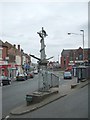
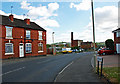
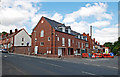
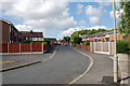
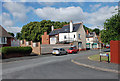
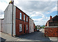
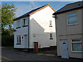
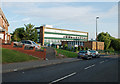
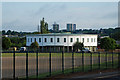
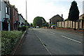
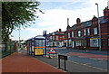
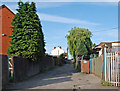
Photos of DY2 9BX
Area Information
Living in DY2 9BX offers a compact, residential experience shaped by its small footprint and high population density. The area covers 849 m² and is home to 1,534 residents, creating a tightly knit community. With a median age of 47, the population skews towards adults aged 30–64, suggesting a stable demographic of homeowners and long-term residents. The area is predominantly composed of houses, reflecting a traditional, low-rise housing stock. While it lacks the sprawling character of larger towns, its proximity to rail and metro stations ensures connectivity to nearby cities. Daily life here balances local amenities with the convenience of transport links. The absence of major environmental constraints, such as protected woodlands or AONB designations, means development is not restricted, though the area’s small size means any expansion is limited. For those seeking a quiet, established neighbourhood with practical access to services, DY2 9BX provides a straightforward, no-frills living environment.
- Area Type
- Postcode
- Area Size
- 849 m²
- Population
- 1534
- Population Density
- 4110 people/km²
The property market in DY2 9BX is characterised by a 42% home ownership rate, indicating that nearly half of the housing stock is rented. Given the area’s small size and the prevalence of houses, the market is likely to be a mix of owner-occupied homes and rental properties. This balance suggests a community that is neither overwhelmingly transient nor entirely static. The dominance of houses over flats or apartments implies a traditional, family-oriented housing stock, which may appeal to those seeking more space than a typical urban area offers. However, the limited area size means competition for properties could be fierce, particularly for buyers seeking to establish a long-term presence. For those considering the area, the mix of ownership and rental options provides flexibility, though the small footprint means any property purchase would need to be evaluated carefully for its long-term suitability within the local context.
House Prices in DY2 9BX
No properties found in this postcode.
Energy Efficiency in DY2 9BX
The lifestyle in DY2 9BX is shaped by its proximity to retail, transport, and local services. Five retail venues are within practical reach, including Aldi Cinder, Aldi Saltwells, and Asda Netherton, offering a range of shopping options for everyday needs. The area’s rail and metro stations provide access to nearby leisure and employment hubs, making it convenient for those who commute or enjoy urban amenities. While the data does not mention parks or recreational spaces, the presence of multiple transport links and retail options suggests a functional, service-oriented lifestyle. The compact nature of the area means that most amenities are within walking distance or a short journey by public transport. For residents prioritising convenience over expansive green spaces, DY2 9BX delivers a straightforward, accessible environment with a focus on practicality rather than luxury.
Amenities
Schools
DY2 9BX is served by a small but functional network of schools. Netherton Park Nursery School provides early years education, while Northfield Road Primary School caters to younger children. The latter is listed twice in the data, but it appears to be a single institution with an Ofsted rating of satisfactory. This combination of nursery and primary schooling offers convenience for families with children of different ages, though the absence of secondary schools means parents may need to look further afield for high school options. The satisfactory Ofsted rating for the primary school indicates it meets minimum standards, but it does not distinguish itself as outstanding. For families prioritising proximity to schools, the availability of both nursery and primary education within the area is a practical advantage, though the lack of higher education facilities may be a limitation.
| Rank | School | Type | Entry gender | Ages |
|---|
Explore more schools in this area
Go to Schools tabDemographics
The community in DY2 9BX is defined by its age profile and home ownership patterns. With a median age of 47 and the majority of residents aged 30–64, the area is dominated by middle-aged adults. Home ownership stands at 42%, indicating a mix of owner-occupied properties and rental units. The predominant accommodation type is houses, which aligns with the area’s low-rise, residential character. The predominant ethnic group is White, reflecting a homogenous demographic. The high population density of 1,805,968 people per km² suggests that the area is efficiently utilised, though it may feel crowded for those accustomed to more spacious settings. This density, combined with the age profile, suggests a community focused on stability rather than rapid growth. The lack of specific data on deprivation means it is unclear how economic factors influence quality of life, but the presence of multiple retail and transport options hints at reasonable accessibility for daily needs.
Household Size
Accommodation Type
Tenure
Ethnic Group
Religion
Household Composition
Age
Household Deprivation
NS-SEC
Explore more demographic insights in this area
Go to Demographics tabPlanning
Planning Constraints
- Flood RiskPremium
- Ramsar Wetland SitesPremium
- Area of Outstanding Natural BeautyPremium
- Protected Nature ReservePremium
- Protected WoodlandPremium