Area Overview for DY2 7LQ
Photos of DY2 7LQ

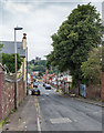
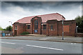
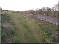
98 photos from this area
Area Information
Key information about the DY2 7LQ including its size, population, and administrative classification.
- Area Type
- Postcode
- Area Size
- 5863 m²
- Population
- 1910
- Population Density
- 7541 people/km²
House Prices in DY2 7LQ
20
Properties
£102,390
Average Sold Price
£64,000
Lowest Price
£140,000
Highest Price
Showing 20 properties
| Address | Type | Beds | Baths | Last Sale Price | Last Sale Date | |
|---|---|---|---|---|---|---|
| 49 Watsons Green Road, Dudley, DY2 7LQ | Terraced | 3 | 2 | £140,000 | May 2025 | |
| 83 Watsons Green Road, Dudley, DY2 7LQ | house | 3 | 1 | £102,000 | Mar 2019 | |
| 61 Watsons Green Road, Dudley, DY2 7LQ | Terraced | 3 | 1 | £90,000 | Dec 2017 | |
| 77 Watsons Green Road, Dudley, DY2 7LQ | house | - | - | £64,000 | Mar 2009 | |
| 55 Watsons Green Road, Dudley, DY2 7LQ | Semi-detached | 3 | 2 | £115,950 | May 2007 | |
| 57 Watsons Green Road, Dudley, DY2 7LQ | Terraced | 3 | 1 | - | - | |
| 47 Watsons Green Road, Dudley, DY2 7LQ | Terraced | - | - | - | - | |
| 59 Watsons Green Road, Dudley, DY2 7LQ | house | - | - | - | - | |
| 81 Watsons Green Road, Dudley, DY2 7LQ | house | - | - | - | - | |
| 65 Watsons Green Road, Dudley, DY2 7LQ | house | - | - | - | - |
Page 1 of 2
Energy Efficiency in DY2 7LQ
Amenities
Schools
| Rank | School | Type | Entry gender | Ages |
|---|
Explore more schools in this area
Go to Schools tabDemographics
Household Size
Family (3-5 people)
most common
Accommodation Type
Houses
most common
Tenure
35
majority
Ethnic Group
White
most common
Religion
N/A
most common
Household Composition
N/A
most common
Age
47
median
Adults (30-64 years)
most common
Household Deprivation
N/A
with no deprivation
NS-SEC
12
in Lower managerial occupations
Explore more demographic insights in this area
Go to Demographics tabPlanning
Planning Constraints
- Flood RiskPremium
- Ramsar Wetland SitesPremium
- Area of Outstanding Natural BeautyPremium
- Protected Nature ReservePremium
- Protected WoodlandPremium