Area Overview for DY2 0NJ
Photos of DY2 0NJ
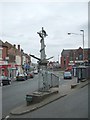
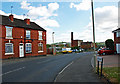
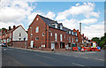
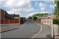
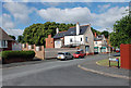
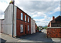
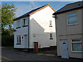


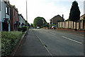
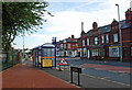
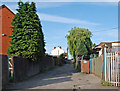
100 photos from this area
Area Information
Key information about the DY2 0NJ including its size, population, and administrative classification.
- Area Type
- Postcode
- Area Size
- 9630 m²
- Population
- 1538
- Population Density
- 3361 people/km²
House Prices in DY2 0NJ
39
Properties
£109,299
Average Sold Price
£20,000
Lowest Price
£185,000
Highest Price
Showing 39 properties
| Address | Type | Beds | Baths | Last Sale Price | Last Sale Date | |
|---|---|---|---|---|---|---|
| 10 Hampton Street, Netherton, DY2 0NJ | Terraced | 3 | 1 | £185,000 | Oct 2025 | |
| 36 Hampton Street, Netherton, DY2 0NJ | Terraced | 2 | 1 | £131,500 | Feb 2025 | |
| 42 Hampton Street, Netherton, DY2 0NJ | Terraced | 3 | 1 | £165,000 | Feb 2024 | |
| 43 Hampton Street, Netherton, DY2 0NJ | Terraced | 2 | 1 | £165,000 | Feb 2024 | |
| 15 Hampton Street, Netherton, DY2 0NJ | Semi-detached | 3 | 1 | £162,500 | Jun 2023 | |
| 27 Hampton Street, Netherton, DY2 0NJ | Terraced | 3 | 1 | £161,000 | Sep 2022 | |
| 9 Hampton Street, Netherton, DY2 0NJ | house | - | - | £128,000 | Oct 2021 | |
| 34 Hampton Street, Netherton, DY2 0NJ | Terraced | 2 | 1 | £117,000 | Oct 2021 | |
| 5 Hampton Street, Netherton, DY2 0NJ | Terraced | - | - | £110,000 | Feb 2021 | |
| 35 Hampton Street, Netherton, DY2 0NJ | Terraced | 3 | 1 | £100,000 | Oct 2020 |
Page 1 of 4
Energy Efficiency in DY2 0NJ
Amenities
Schools
| Rank | School | Type | Entry gender | Ages |
|---|
Explore more schools in this area
Go to Schools tabDemographics
Household Size
Two person
most common
Accommodation Type
Houses
most common
Tenure
76
majority
Ethnic Group
White
most common
Religion
N/A
most common
Household Composition
N/A
most common
Age
47
median
Adults (30-64 years)
most common
Household Deprivation
N/A
with no deprivation
NS-SEC
21
in Lower managerial occupations
Explore more demographic insights in this area
Go to Demographics tabPlanning
Planning Constraints
- Flood RiskPremium
- Ramsar Wetland SitesPremium
- Area of Outstanding Natural BeautyPremium
- Protected Nature ReservePremium
- Protected WoodlandPremium