Area Overview for DY14 8BE
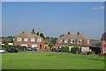
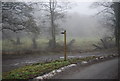
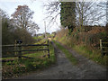
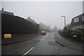
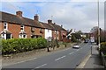
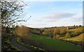
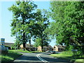
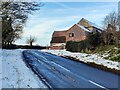
Photos of DY14 8BE
Area Information
Living in DY14 8BE means being part of a small, tightly knit residential cluster in England, home to 1,408 residents. This area is defined by its modest scale and quiet character, with a population that skews towards adults aged 30–64, reflecting a community rooted in stability and routine. The median age of 47 suggests a mature demographic, often associated with established households and long-term residency. Most properties here are houses, with nearly 57% owned by residents, indicating a strong sense of local attachment. The area’s low flood risk and absence of environmental constraints like protected woodlands or wetlands make it a practical choice for those prioritising safety and ease of planning. Nearby, the Severn Valley Railway Station offers rail access, while two retail spots—Co-op Cleobury and Budgens Far—provide basic shopping needs. Though small, DY14 8BE balances simplicity with accessibility, offering a slice of rural living without sacrificing connection to essential services.
- Area Type
- Postcode
- Area Size
- Not available
- Population
- 1408
- Population Density
- 4299 people/km²
The property market in DY14 8BE is shaped by its small size and focus on owner-occupied homes. With 57% of residents owning their properties, this area leans heavily towards home ownership rather than rental activity. The accommodation type is predominantly houses, which are typically larger and more suited to families or individuals seeking space. This suggests a housing stock that caters to those prioritising privacy and stability over high-density living. However, the limited data on property prices or availability means buyers must consider the area’s restricted size—DY14 8BE is a specific postcode covering a small cluster, so opportunities for expansion or alternative housing options are minimal. For those seeking a quiet, low-maintenance lifestyle, the existing homes here may be appealing, but the market’s insularity could limit choices for those needing larger properties or proximity to urban amenities.
House Prices in DY14 8BE
No properties found in this postcode.
Energy Efficiency in DY14 8BE
Residents of DY14 8BE have access to a handful of essential amenities within practical reach. The Co-op Cleobury and Budgens Far provide basic retail options, covering groceries and everyday essentials. These shops are critical for a small community, reducing the need for longer trips to larger centres. The Severn Valley Railway Station adds value by offering rail connectivity, which can be a lifeline for commuting or exploring nearby areas. While the area lacks larger leisure or recreational facilities, its compact nature ensures that daily needs are met without excessive travel. The presence of two retail points and a railway station contributes to a functional, low-effort lifestyle, ideal for those prioritising convenience over extensive amenities. However, the absence of parks or dining options means residents may need to venture further for more diverse leisure activities.
Amenities
Schools
| Rank | School | Type | Entry gender | Ages |
|---|
Explore more schools in this area
Go to Schools tabDemographics
DY14 8BE’s population of 1,408 is predominantly composed of adults aged 30–64, with a median age of 47. This suggests a community of middle-aged individuals, many of whom are likely in their prime working years or nearing retirement. Home ownership sits at 57%, meaning nearly half the residents own their properties, while the remaining 43% may be renting. The area is characterised by houses rather than flats, reflecting a preference for standalone homes. The predominant ethnic group is White, with no data provided on other demographics. This profile indicates a stable, settled population with fewer transient residents. The absence of specific deprivation data means it’s unclear how economic challenges might affect quality of life, but the low crime score of 76 suggests a generally secure environment. The demographic makeup supports a community focused on long-term living, with a strong emphasis on family-oriented or independent households.
Household Size
Accommodation Type
Tenure
Ethnic Group
Religion
Household Composition
Age
Household Deprivation
NS-SEC
Explore more demographic insights in this area
Go to Demographics tabPlanning
Planning Constraints
- Flood RiskPremium
- Ramsar Wetland SitesPremium
- Area of Outstanding Natural BeautyPremium
- Protected Nature ReservePremium
- Protected WoodlandPremium