Area Overview for DY13 0RR
Photos of DY13 0RR
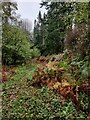
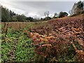
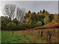
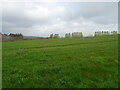

14 photos from this area
Area Information
Key information about the DY13 0RR including its size, population, and administrative classification.
- Area Type
- Postcode
- Area Size
- 34.4 hectares
- Population
- 2208
- Population Density
- 70 people/km²
House Prices in DY13 0RR
10
Properties
£1,284,333
Average Sold Price
£110,000
Lowest Price
£2,528,000
Highest Price
Showing 10 properties
| Address | Type | Beds | Baths | Last Sale Price | Last Sale Date | |
|---|---|---|---|---|---|---|
| Solhampton Farm, B 4196 Astley, Astley, DY13 0RR | Bungalow | - | - | £2,528,000 | Sep 2022 | |
| The Old Hill, B 4196 Astley, Astley, DY13 0RR | Detached | - | - | £1,215,000 | Oct 2009 | |
| 2, Bensons Cottages, B 4196 Astley, Astley, DY13 0RR | house | - | - | £110,000 | Jul 1999 | |
| Plum Tree Cottage, B 4196 Astley, Astley, DY13 0RR | house | 4 | 1 | - | - | |
| Lower Old Hill, B 4196 Astley, Astley, DY13 0RR | Detached | - | - | - | - | |
| Old Court, B 4196 Astley, Astley, DY13 0RR | house | - | - | - | - | |
| The Garden House, B 4196 Astley, Astley, DY13 0RR | house | - | - | - | - | |
| Unit 6, Solhampton Farm, B 4196 Astley, Astley, DY13 0RR | Farm | - | - | - | - | |
| Unit 4A, Solhampton Farm, B 4196 Astley, Astley, DY13 0RR | commercial | - | - | - | - | |
| Solhampton Fishery At, Solhampton Farm, B 4196 Astley, Astley, DY13 0RR | secure_residential | - | - | - | - |
Energy Efficiency in DY13 0RR
Amenities
Schools
| Rank | School | Type | Entry gender | Ages |
|---|
Explore more schools in this area
Go to Schools tabDemographics
Household Size
Two person
most common
Accommodation Type
Houses
most common
Tenure
79
majority
Ethnic Group
White
most common
Religion
N/A
most common
Household Composition
N/A
most common
Age
47
median
Adults (30-64 years)
most common
Household Deprivation
N/A
with no deprivation
NS-SEC
41
in Lower managerial occupations
Explore more demographic insights in this area
Go to Demographics tabPlanning
Planning Constraints
- Flood RiskPremium
- Ramsar Wetland SitesPremium
- Area of Outstanding Natural BeautyPremium
- Protected Nature ReservePremium
- Protected WoodlandPremium