Area Overview for DY12 1YW
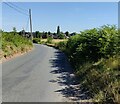
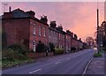
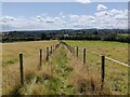
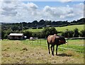
Photos of DY12 1YW


Area Information
DY12 1YW is a small residential postcode area in England, home to 1,733 people spread across a compact cluster of homes. With a population density of 322 people per square kilometre, it reflects a tight-knit community where proximity to amenities and services is a key feature. The area is characterised by its modest scale, offering a quiet alternative to larger towns while maintaining access to essential infrastructure. Residents here are predominantly adults aged 30–64, with a median age of 47, suggesting a mature, stable population. The high rate of home ownership (82%) and prevalence of houses over flats indicate a focus on family-oriented living. Daily life in DY12 1YW balances local convenience with broader connectivity, with nearby schools, retail outlets, and rail links. The area’s low flood risk and absence of protected natural sites mean it avoids the constraints often found in more environmentally sensitive regions. For those seeking a settled, low-maintenance lifestyle with access to practical amenities, DY12 1YW offers a straightforward, unpretentious option.
- Area Type
- Postcode
- Area Size
- Not available
- Population
- 1733
- Population Density
- 322 people/km²
The property market in DY12 1YW is dominated by owner-occupied homes, with 82% of properties owned outright. This high rate of home ownership contrasts with areas where rental markets are more prevalent, indicating a community that values stability and long-term investment. The accommodation type is predominantly houses, which are more common than flats or apartments in this small postcode area. This suggests a focus on traditional, family-friendly housing stock, with limited scope for newer developments or alternative property types. For buyers, this means a market where properties are likely to be well-maintained and suited to those seeking a settled lifestyle. The small size of the area and the prevalence of houses may also mean a limited inventory of available properties, requiring buyers to consider nearby regions for more options. The absence of rental properties implies that those entering the market should assess their long-term plans, as the area is unlikely to cater to short-term or transient needs.
House Prices in DY12 1YW
No properties found in this postcode.
Energy Efficiency in DY12 1YW
The lifestyle in DY12 1YW is shaped by its proximity to retail and transport hubs. Nearby shops include Co-op Petrol, Tesco Bewdley, and Sainsburys Bewdley, offering a range of grocery and convenience services. These outlets provide daily essentials, reducing the need for long journeys to larger centres. The area’s rail stations, including Severn Valley and Kidderminster, connect residents to broader networks, enabling access to cultural, leisure, and employment opportunities beyond the immediate postcode. While the data does not list parks or leisure facilities directly, the absence of planning constraints such as protected woodlands or AONBs suggests open spaces may be available nearby. The combination of retail convenience and transport links makes daily life practical, with minimal disruption to routines. For those seeking a balance between local accessibility and regional connectivity, DY12 1YW offers a straightforward, functional lifestyle.
Amenities
Schools
Residents of DY12 1YW have access to two independent schools: Lea House School and Wribbenhall School. Both institutions cater to private education, offering alternatives to state-funded options. Wribbenhall School holds a ‘good’ Ofsted rating, which reflects its performance in areas such as pupil outcomes and staff quality. The presence of two independent schools suggests that families prioritising private education are well-served in this area. However, the data does not indicate the availability of state schools, which may be a consideration for those seeking a broader range of educational options. The mix of school types means parents can choose between independent institutions or potentially state schools in nearby areas. For families valuing academic flexibility, the proximity to these schools provides a clear advantage, though the absence of state school data means further research may be needed to fully assess local educational provision.
| Rank | School | Type | Entry gender | Ages |
|---|
Explore more schools in this area
Go to Schools tabDemographics
The community in DY12 1YW is predominantly composed of adults aged 30–64, with a median age of 47. This suggests a population that is largely in their prime working and family-raising years, with fewer younger or older residents. Home ownership is high, at 82%, indicating a strong preference for long-term residency over rental properties. The accommodation type is overwhelmingly houses, which aligns with the area’s character as a residential cluster rather than a high-density urban zone. The predominant ethnic group is White, reflecting the broader demographic patterns of rural and semi-rural England. The absence of specific data on deprivation levels means the area’s quality of life can be inferred from its low crime risk and access to services. With no notable diversity metrics provided, the community appears homogenous, which may influence social dynamics and local amenities. The age profile and home ownership figures suggest a stable, low-turnover environment where residents are likely to remain for extended periods.
Household Size
Accommodation Type
Tenure
Ethnic Group
Religion
Household Composition
Age
Household Deprivation
NS-SEC
Explore more demographic insights in this area
Go to Demographics tabPlanning
Planning Constraints
- Flood RiskPremium
- Ramsar Wetland SitesPremium
- Area of Outstanding Natural BeautyPremium
- Protected Nature ReservePremium
- Protected WoodlandPremium