Area Overview for DY11 7YE
Photos of DY11 7YE

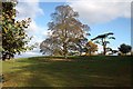
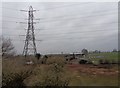
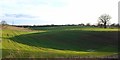
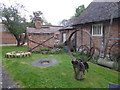


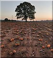


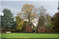

37 photos from this area
Area Information
Key information about the DY11 7YE including its size, population, and administrative classification.
- Area Type
- Postcode
- Area Size
- 19.9 hectares
- Population
- 1437
- Population Density
- 133 people/km²
House Prices in DY11 7YE
20
Properties
£429,444
Average Sold Price
£175,000
Lowest Price
£740,000
Highest Price
Showing 20 properties
| Address | Type | Beds | Baths | Last Sale Price | Last Sale Date | |
|---|---|---|---|---|---|---|
| Charlton Mill, Stourport Road, Charlton, Hartlebury, DY11 7YE | house | 6 | 3 | £740,000 | Dec 2023 | |
| Rock Lodge, Stourport Road, Charlton, Hartlebury, DY11 7YE | house | - | - | £645,000 | Feb 2021 | |
| Charlton Meadow, Stourport Road, Charlton, Hartlebury, DY11 7YE | Detached | 3 | 1 | £663,000 | Apr 2020 | |
| 1, Charlton Cottages, Stourport Road, Charlton, Hartlebury, DY11 7YE | Cottage | 3 | 2 | £305,000 | Aug 2018 | |
| Mole End, Stourport Road, Charlton, Hartlebury, DY11 7YE | house | - | - | £510,000 | Aug 2017 | |
| 2, Charlton Cottages, Stourport Road, Charlton, Hartlebury, DY11 7YE | Cottage | 3 | - | £290,000 | Jul 2015 | |
| Pound Cottage, Stourport Road, Charlton, Hartlebury, DY11 7YE | house | - | - | £357,000 | Aug 2011 | |
| Charlton Stables, Stourport Road, Charlton, Hartlebury, DY11 7YE | Terraced | - | - | £175,000 | Oct 2005 | |
| White Cottage, Stourport Road, Charlton, Hartlebury, DY11 7YE | Detached | 4 | - | £180,000 | Aug 1996 | |
| Charlton Farm, Stourport Road, Charlton, Hartlebury, DY11 7YE | Land | 6 | 3 | - | - |
Page 1 of 2
Energy Efficiency in DY11 7YE
Amenities
Schools
| Rank | School | Type | Entry gender | Ages |
|---|
Explore more schools in this area
Go to Schools tabDemographics
Household Size
Two person
most common
Accommodation Type
Houses
most common
Tenure
79
majority
Ethnic Group
White
most common
Religion
N/A
most common
Household Composition
N/A
most common
Age
47
median
Adults (30-64 years)
most common
Household Deprivation
N/A
with no deprivation
NS-SEC
44
in Lower managerial occupations
Explore more demographic insights in this area
Go to Demographics tabPlanning
Planning Constraints
- Flood RiskPremium
- Ramsar Wetland SitesPremium
- Area of Outstanding Natural BeautyPremium
- Protected Nature ReservePremium
- Protected WoodlandPremium