Area Overview for DY11 7AA
Photos of DY11 7AA

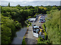
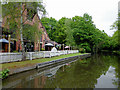
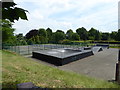
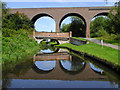

100 photos from this area
Area Information
Key information about the DY11 7AA including its size, population, and administrative classification.
- Area Type
- Postcode
- Area Size
- 2.0 hectares
- Population
- 1665
- Population Density
- 3743 people/km²
House Prices in DY11 7AA
19
Properties
£201,909
Average Sold Price
£125,000
Lowest Price
£287,000
Highest Price
Showing 19 properties
| Address | Type | Beds | Baths | Last Sale Price | Last Sale Date | |
|---|---|---|---|---|---|---|
| 57 Larches Road, Kidderminster, DY11 7AA | house | 3 | 1 | £270,000 | Mar 2025 | |
| 1A Larches Road, Kidderminster, DY11 7AA | Detached | 2 | 1 | £205,250 | Mar 2024 | |
| 53 Larches Road, Kidderminster, DY11 7AA | Detached | 3 | 1 | £257,000 | Jun 2022 | |
| 3 Larches Road, Kidderminster, DY11 7AA | Semi-detached | - | - | £235,000 | May 2022 | |
| 2 Larches Road, Kidderminster, DY11 7AA | house | - | - | £287,000 | Jul 2021 | |
| Toadies Place, 56 Larches Road, Kidderminster, DY11 7AA | house | - | - | £176,250 | Jul 2018 | |
| 58 Larches Road, Kidderminster, DY11 7AA | Detached | 3 | 1 | £188,000 | Oct 2017 | |
| 5 Larches Road, Kidderminster, DY11 7AA | house | 3 | - | £160,000 | Sep 2012 | |
| 52 Larches Road, Kidderminster, DY11 7AA | house | - | - | £125,000 | May 2012 | |
| 4 Larches Road, Kidderminster, DY11 7AA | Semi-detached | - | - | £180,000 | Sep 2003 |
Page 1 of 2
Energy Efficiency in DY11 7AA
Amenities
Schools
| Rank | School | Type | Entry gender | Ages |
|---|
Explore more schools in this area
Go to Schools tabDemographics
Household Size
Two person
most common
Accommodation Type
Houses
most common
Tenure
67
majority
Ethnic Group
White
most common
Religion
N/A
most common
Household Composition
N/A
most common
Age
47
median
Adults (30-64 years)
most common
Household Deprivation
N/A
with no deprivation
NS-SEC
27
in Lower managerial occupations
Explore more demographic insights in this area
Go to Demographics tabPlanning
Planning Constraints
- Flood RiskPremium
- Ramsar Wetland SitesPremium
- Area of Outstanding Natural BeautyPremium
- Protected Nature ReservePremium
- Protected WoodlandPremium