Area Overview for DY11 6BW
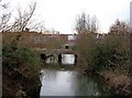
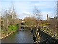
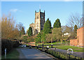
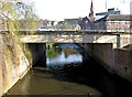
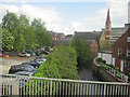
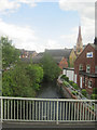
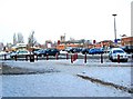
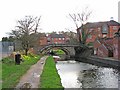
Photos of DY11 6BW
Area Information
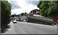
Living in DY11 6BW offers a compact, residential experience shaped by its small cluster of homes and proximity to essential services. With a population of 1,499, the area feels intimate, catering to a community of primarily middle-aged residents. The median age of 47 suggests a stable, established demographic, with most households falling within the 30-64 age range. Home ownership is exceptionally high at 89%, reflecting a preference for long-term residency over rental properties. The area is characterised by houses rather than flats, which contributes to a more traditional, family-oriented environment. Nearby, schools such as Baxter Business and Enterprise College and Baxter College provide primary and academy education, ensuring children have access to local learning opportunities. Digital connectivity is robust, with a broadband score of 100, though mobile coverage scores at 83, which is good but not exceptional. Transport links are practical, with multiple rail stations within reach, connecting residents to wider networks. While the area lacks natural constraints like protected woodlands or wetlands, it carries a medium crime risk, requiring standard security measures. For those seeking a quiet, self-contained community with practical amenities, DY11 6BW balances convenience with a sense of place.
- Area Type
- Postcode
- Area Size
- Not available
- Population
- 1499
- Population Density
- 2941 people/km²
DY11 6BW is a predominantly owner-occupied area, with 89% of homes owned by residents rather than rented. The accommodation type is exclusively houses, which contrasts with areas where flats or apartments dominate. This suggests a housing stock tailored to families or individuals seeking space and privacy, rather than urban or high-density living. The small population of 1,499 and the focus on houses indicate a limited number of properties, which may make the market competitive for buyers. The high home ownership rate also implies that rental availability is minimal, potentially reducing the appeal for those seeking short-term or flexible housing. For buyers, this means properties are likely to be long-term investments, with little turnover. The absence of data on property prices or recent transactions means the market’s value proposition remains opaque, but the emphasis on owner-occupation and traditional housing suggests a conservative, stable market.
House Prices in DY11 6BW
No properties found in this postcode.
Energy Efficiency in DY11 6BW
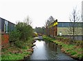
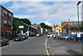
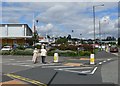
The lifestyle in DY11 6BW is shaped by its proximity to retail and transport hubs. Nearby shops include Tesco Bewdley, Spar, and Tesco Foley, providing everyday essentials within walking or short driving distance. These retail options cater to daily needs, from groceries to convenience items, reducing the necessity for long trips. The rail stations of Kidderminster, Hartlebury, and Blakedown offer access to broader networks, enabling residents to travel for work, leisure, or socialising. While the area lacks detailed data on parks or leisure facilities, the presence of multiple retail outlets and rail links suggests a focus on practicality over expansive recreational spaces. The compact nature of DY11 6BW means amenities are concentrated, which can be both a convenience and a limitation. For those prioritising ease of access to shopping and transport, this area delivers, though larger-scale leisure options may require venturing further afield.
Amenities
Schools
Residents of DY11 6BW have access to three schools within practical reach: Baxter Business and Enterprise College, a primary school; Baxter College, another primary school; and Baxter College, an academy. The presence of two primary schools offers families multiple options for early education, while the academy provides a different educational structure, potentially with specialist curricula or governance. The repetition of the school name “Baxter College” for both primary and academy types may indicate a network of institutions under the same name but differing in focus. For families, this mix allows for choices between traditional primary education and academies, which often have distinct teaching methods or subject specialisms. However, the data does not specify Ofsted ratings or academic performance, so the quality of education remains unassessed here. The proximity of these schools to homes in DY11 6BW ensures children have access to local learning without long commutes.
| Rank | School | Type | Entry gender | Ages |
|---|
Explore more schools in this area
Go to Schools tabDemographics
The community in DY11 6BW is predominantly composed of adults aged 30-64, with a median age of 47. This suggests a mature, settled population, likely with established careers and family ties. Home ownership is exceptionally high at 89%, indicating a strong preference for long-term residency over rental properties. The accommodation type is exclusively houses, which aligns with the area’s traditional, non-urban character. The predominant ethnic group is White, with no data provided on other demographics. The high home ownership rate and age profile suggest a community focused on stability and continuity. The absence of specific data on deprivation or diversity means the area’s social dynamics remain largely unexplored in this context. However, the high proportion of owner-occupied homes implies a lower reliance on rental markets, which may influence local services and infrastructure planning. For prospective buyers, this demographic profile signals a neighbourhood that prioritises long-term living over transient populations.
Household Size
Accommodation Type
Tenure
Ethnic Group
Religion
Household Composition
Age
Household Deprivation
NS-SEC
Explore more demographic insights in this area
Go to Demographics tabPlanning
Planning Constraints
- Flood RiskPremium
- Ramsar Wetland SitesPremium
- Area of Outstanding Natural BeautyPremium
- Protected Nature ReservePremium
- Protected WoodlandPremium