Area Overview for DY11 5HS
Photos of DY11 5HS
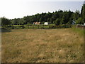
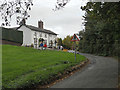
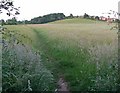


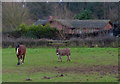
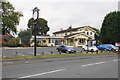
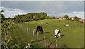
78 photos from this area
Area Information
Key information about the DY11 5HS including its size, population, and administrative classification.
- Area Type
- Postcode
- Area Size
- 8956 m²
- Population
- 1317
- Population Density
- 3337 people/km²
House Prices in DY11 5HS
15
Properties
£130,944
Average Sold Price
£20,000
Lowest Price
£250,000
Highest Price
Showing 15 properties
| Address | Type | Beds | Baths | Last Sale Price | Last Sale Date | |
|---|---|---|---|---|---|---|
| 139 Marlpool Lane, Kidderminster, DY11 5HS | house | 3 | 1 | £250,000 | Jul 2025 | |
| 140 Marlpool Lane, Kidderminster, DY11 5HS | Semi-detached | 3 | 1 | £206,000 | Feb 2019 | |
| 136 Marlpool Lane, Kidderminster, DY11 5HS | Semi-detached | 3 | - | £136,500 | Apr 2014 | |
| 128 Marlpool Lane, Kidderminster, DY11 5HS | house | - | - | £140,000 | Mar 2013 | |
| 134 Marlpool Lane, Kidderminster, DY11 5HS | Detached | 4 | 2 | £170,000 | Jan 2012 | |
| 141 Marlpool Lane, Kidderminster, DY11 5HS | house | 3 | 1 | £140,000 | Nov 2010 | |
| 144 Marlpool Lane, Kidderminster, DY11 5HS | Detached | 3 | 2 | £66,000 | Oct 1999 | |
| 142 Marlpool Lane, Kidderminster, DY11 5HS | Semi-detached | - | - | £20,000 | Nov 1995 | |
| 146 Marlpool Lane, Kidderminster, DY11 5HS | Semi-detached | - | - | £50,000 | Apr 1995 | |
| 143 Marlpool Lane, Kidderminster, DY11 5HS | Semi-detached | - | - | - | - |
Page 1 of 2
Energy Efficiency in DY11 5HS
Amenities
Schools
| Rank | School | Type | Entry gender | Ages |
|---|
Explore more schools in this area
Go to Schools tabDemographics
Household Size
Two person
most common
Accommodation Type
Houses
most common
Tenure
88
majority
Ethnic Group
White
most common
Religion
N/A
most common
Household Composition
N/A
most common
Age
47
median
Adults (30-64 years)
most common
Household Deprivation
N/A
with no deprivation
NS-SEC
30
in Lower managerial occupations
Explore more demographic insights in this area
Go to Demographics tabPlanning
Planning Constraints
- Flood RiskPremium
- Ramsar Wetland SitesPremium
- Area of Outstanding Natural BeautyPremium
- Protected Nature ReservePremium
- Protected WoodlandPremium