Area Overview for DY10 3HF
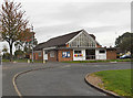
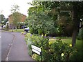
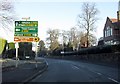
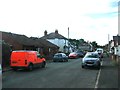
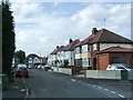
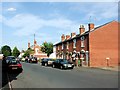
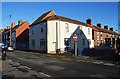
Photos of DY10 3HF


Area Information
DY10 3HF is a small, tightly knit residential postcode area in England, home to 1480 people. Its compact size means it feels more like a quiet village than a sprawling suburb, with a focus on local living. The community is predominantly composed of adults aged 30–64, with a median age of 47, suggesting a stable population of homeowners and long-term residents. Daily life here is shaped by proximity to nearby amenities, including five rail stations and multiple retail outlets. The area’s low flood risk and absence of environmental constraints make it a practical choice for families and professionals. While not a bustling urban hub, DY10 3HF offers a balance of convenience and tranquillity, with easy access to essential services. Its small scale means a strong sense of community, where familiar faces and local routines are the norm. For those seeking a place to settle without the pressures of city life, this area provides a straightforward, no-frills lifestyle.
- Area Type
- Postcode
- Area Size
- Not available
- Population
- 1480
- Population Density
- 3047 people/km²
The property market in DY10 3HF is defined by its low home ownership rate of 45%, suggesting that the area is more rental-focused than owner-occupied. The accommodation type is predominantly houses, which may cater to families or individuals seeking larger living spaces. Given the small size of the postcode, the housing stock is limited, and buyers should consider the surrounding areas for more options. The lack of flats or apartments implies a market skewed towards traditional homes, which may be more appealing to those seeking a suburban feel. However, the 45% home ownership figure indicates that a significant portion of properties are rented, potentially offering opportunities for investors. For buyers, this means competition may be lower, but the range of properties available is constrained by the area’s compact nature.
House Prices in DY10 3HF
No properties found in this postcode.
Energy Efficiency in DY10 3HF
Living in DY10 3HF means having access to essential retail and transport hubs within practical reach. The area’s proximity to Tesco Kidderminster, Morrisons Kidderminster, and Tesco Spennells ensures that daily shopping needs are met without long commutes. These stores cater to a range of requirements, from groceries to household items, supporting a self-sufficient lifestyle. Rail connectivity is another key feature, with five stations offering links to nearby towns and cities. This makes it easy to access cultural, professional, or leisure opportunities beyond the immediate postcode. While there is no data on parks or leisure facilities, the presence of multiple retail and transport points suggests a community focused on practicality over luxury. The lifestyle here is straightforward, prioritising convenience and accessibility over expansive amenities.
Amenities
Schools
| Rank | School | Type | Entry gender | Ages |
|---|
Explore more schools in this area
Go to Schools tabDemographics
The population of DY10 3HF is predominantly adults aged 30–64, reflecting a mature demographic with a median age of 47. This suggests a community of established professionals, families, and retirees, with fewer young households or students. Home ownership is relatively low at 45%, indicating that nearly half of residents rent their homes. The area is characterised by houses rather than flats, which may appeal to those prioritising space and privacy. The predominant ethnic group is White, with no specific data on other ethnicities provided. While no figures on deprivation are available, the combination of moderate home ownership and a stable age profile implies a community with mixed economic diversity. The absence of younger residents may mean fewer schools or childcare facilities, though this is not explicitly stated in the data.
Household Size
Accommodation Type
Tenure
Ethnic Group
Religion
Household Composition
Age
Household Deprivation
NS-SEC
Explore more demographic insights in this area
Go to Demographics tabPlanning
Planning Constraints
- Flood RiskPremium
- Ramsar Wetland SitesPremium
- Area of Outstanding Natural BeautyPremium
- Protected Nature ReservePremium
- Protected WoodlandPremium