Area Overview for DY10 2YS
Photos of DY10 2YS
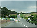

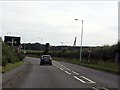
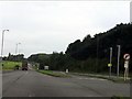
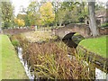
60 photos from this area
Area Information
Key information about the DY10 2YS including its size, population, and administrative classification.
- Area Type
- Postcode
- Area Size
- 1.1 hectares
- Population
- 1509
- Population Density
- 3378 people/km²
House Prices in DY10 2YS
23
Properties
£124,240
Average Sold Price
£50,000
Lowest Price
£210,000
Highest Price
Showing 23 properties
| Address | Type | Beds | Baths | Last Sale Price | Last Sale Date | |
|---|---|---|---|---|---|---|
| 21 Dunnington Avenue, Kidderminster, DY10 2YS | house | - | - | £195,000 | Jan 2024 | |
| 27 Dunnington Avenue, Kidderminster, DY10 2YS | house | - | - | £210,000 | Sep 2021 | |
| 43 Dunnington Avenue, Kidderminster, DY10 2YS | house | 3 | 2 | £180,000 | Mar 2019 | |
| 35 Dunnington Avenue, Kidderminster, DY10 2YS | Semi-detached | - | - | £165,000 | Aug 2018 | |
| 15 Dunnington Avenue, Kidderminster, DY10 2YS | Semi-detached | 4 | 1 | £165,000 | Sep 2016 | |
| 9 Dunnington Avenue, Kidderminster, DY10 2YS | Semi-detached | 3 | - | £137,500 | Dec 2015 | |
| 11 Dunnington Avenue, Kidderminster, DY10 2YS | Semi-detached | 3 | - | £123,000 | Oct 2013 | |
| 33 Dunnington Avenue, Kidderminster, DY10 2YS | house | - | - | £108,000 | Jun 2012 | |
| 29 Dunnington Avenue, Kidderminster, DY10 2YS | Semi-detached | - | - | £135,600 | Mar 2010 | |
| 41 Dunnington Avenue, Kidderminster, DY10 2YS | house | - | - | £100,000 | Dec 2004 |
Page 1 of 3
Energy Efficiency in DY10 2YS
Amenities
Schools
| Rank | School | Type | Entry gender | Ages |
|---|
Explore more schools in this area
Go to Schools tabDemographics
Household Size
Two person
most common
Accommodation Type
Houses
most common
Tenure
85
majority
Ethnic Group
White
most common
Religion
N/A
most common
Household Composition
N/A
most common
Age
47
median
Adults (30-64 years)
most common
Household Deprivation
N/A
with no deprivation
NS-SEC
29
in Lower managerial occupations
Explore more demographic insights in this area
Go to Demographics tabPlanning
Planning Constraints
- Flood RiskPremium
- Ramsar Wetland SitesPremium
- Area of Outstanding Natural BeautyPremium
- Protected Nature ReservePremium
- Protected WoodlandPremium