Area Overview for DY1 4RF
Photos of DY1 4RF

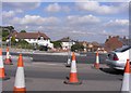
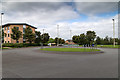
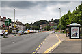
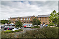
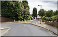
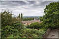
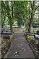
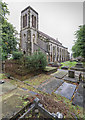
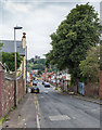
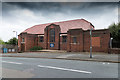
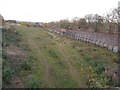
98 photos from this area
Area Information
Key information about the DY1 4RF including its size, population, and administrative classification.
- Area Type
- Postcode
- Area Size
- 1.6 hectares
- Population
- 1866
- Population Density
- 7736 people/km²
House Prices in DY1 4RF
22
Properties
£123,980
Average Sold Price
£42,750
Lowest Price
£300,000
Highest Price
Showing 22 properties
| Address | Type | Beds | Baths | Last Sale Price | Last Sale Date | |
|---|---|---|---|---|---|---|
| 124 Birmingham Road, Dudley, DY1 4RF | Semi-detached | 4 | 1 | £235,000 | Nov 2025 | |
| 76 Birmingham Road, Dudley, DY1 4RF | Flat | 3 | 2 | £120,000 | Aug 2025 | |
| 80 Birmingham Road, Dudley, DY1 4RF | Terraced | 1 | 1 | £300,000 | Feb 2025 | |
| 78 Birmingham Road, Dudley, DY1 4RF | Retail | 3 | 1 | £150,000 | Jan 2023 | |
| 126 Birmingham Road, Dudley, DY1 4RF | Retail | 3 | 1 | £145,000 | Dec 2021 | |
| 112A Birmingham Road, Dudley, DY1 4RF | Semi-detached | 2 | - | £150,000 | Aug 2021 | |
| 120 Birmingham Road, Dudley, DY1 4RF | Semi-detached | 3 | 1 | £107,000 | Sep 2015 | |
| 128 Birmingham Road, Dudley, DY1 4RF | Semi-detached | 3 | 1 | £80,000 | Jan 2014 | |
| 106 Birmingham Road, Dudley, DY1 4RF | house | 3 | - | £104,000 | Jan 2011 | |
| 110 Birmingham Road, Dudley, DY1 4RF | Flat | 2 | 1 | £116,000 | Jun 2009 |
Page 1 of 3
Energy Efficiency in DY1 4RF
Amenities
Schools
| Rank | School | Type | Entry gender | Ages |
|---|
Explore more schools in this area
Go to Schools tabDemographics
Household Size
Family (3-5 people)
most common
Accommodation Type
Houses
most common
Tenure
50
majority
Ethnic Group
White
most common
Religion
N/A
most common
Household Composition
N/A
most common
Age
47
median
Adults (30-64 years)
most common
Household Deprivation
N/A
with no deprivation
NS-SEC
16
in Lower managerial occupations
Explore more demographic insights in this area
Go to Demographics tabPlanning
Planning Constraints
- Flood RiskPremium
- Ramsar Wetland SitesPremium
- Area of Outstanding Natural BeautyPremium
- Protected Nature ReservePremium
- Protected WoodlandPremium