Area Overview for DY1 3TN
Photos of DY1 3TN
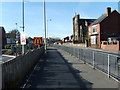
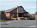
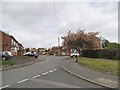
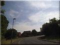
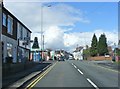
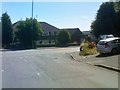
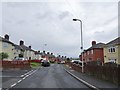
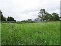
100 photos from this area
Area Information
Key information about the DY1 3TN including its size, population, and administrative classification.
- Area Type
- Postcode
- Area Size
- 1.8 hectares
- Population
- 1334
- Population Density
- 5828 people/km²
House Prices in DY1 3TN
41
Properties
£115,583
Average Sold Price
£41,950
Lowest Price
£230,000
Highest Price
Showing 41 properties
| Address | Type | Beds | Baths | Last Sale Price | Last Sale Date | |
|---|---|---|---|---|---|---|
| 7 Heath Green, Dudley, DY1 3TN | Semi-detached | 2 | 1 | £230,000 | Jun 2025 | |
| 13 Heath Green, Dudley, DY1 3TN | house | - | - | £79,800 | Apr 2025 | |
| 22 Heath Green, Dudley, DY1 3TN | Semi-detached | 3 | 1 | £130,500 | Jan 2025 | |
| 1B Heath Green, Dudley, DY1 3TN | house | 2 | 1 | £140,500 | May 2022 | |
| 14 Heath Green, Dudley, DY1 3TN | house | - | - | £150,000 | Mar 2021 | |
| 11 Heath Green, Dudley, DY1 3TN | house | - | - | £145,000 | Nov 2020 | |
| 32 Heath Green, Dudley, DY1 3TN | Semi-detached | 3 | 1 | £150,000 | Nov 2018 | |
| 16 Heath Green, Dudley, DY1 3TN | Semi-detached | 3 | - | £122,000 | Jul 2017 | |
| 3B Heath Green, Dudley, DY1 3TN | Terraced | 2 | 1 | £85,500 | Jun 2016 | |
| 15 Heath Green, Dudley, DY1 3TN | Semi-detached | 3 | 1 | £85,000 | Mar 2016 |
Page 1 of 5
Energy Efficiency in DY1 3TN
Amenities
Schools
| Rank | School | Type | Entry gender | Ages |
|---|
Explore more schools in this area
Go to Schools tabDemographics
Household Size
Family (3-5 people)
most common
Accommodation Type
Houses
most common
Tenure
70
majority
Ethnic Group
White
most common
Religion
N/A
most common
Household Composition
N/A
most common
Age
47
median
Adults (30-64 years)
most common
Household Deprivation
N/A
with no deprivation
NS-SEC
23
in Lower managerial occupations
Explore more demographic insights in this area
Go to Demographics tabPlanning
Planning Constraints
- Flood RiskPremium
- Ramsar Wetland SitesPremium
- Area of Outstanding Natural BeautyPremium
- Protected Nature ReservePremium
- Protected WoodlandPremium