Area Overview for DY1 3JE
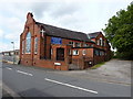
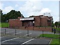
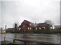
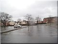
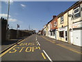
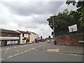
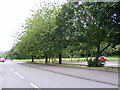
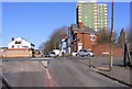
Photos of DY1 3JE


Area Information
Living in DY1 3JE means inhabiting a compact residential cluster in England, where 1,472 people reside across 4,363 square metres. The area’s high population density of 337,350 people per square kilometre reflects a tightly woven community, with residents often sharing proximity to local amenities. The postcode is characterised by a mature demographic, with a median age of 47 and a majority of residents aged 30–64. This suggests a stable, established population, likely with families and professionals. The area’s small size means daily life is centred around nearby schools, shops, and transport links. Flats dominate the housing stock, indicating a mix of rental and owner-occupied properties. While the area lacks natural or protected landscapes, its proximity to rail and metro stations, along with a range of retail options, makes it practical for commuters and families seeking convenience. The balance between density and accessibility defines DY1 3JE as a functional, if compact, place to live.
- Area Type
- Postcode
- Area Size
- 4363 m²
- Population
- 1472
- Population Density
- 3470 people/km²
DY1 3JE’s property market is defined by a low home ownership rate of 25%, indicating that the majority of properties are rented rather than owned. Flats are the dominant accommodation type, which is typical in high-density areas. This suggests a focus on smaller, more manageable living spaces, often suited to individuals or couples rather than larger families. The small area size and limited housing stock mean that buyers may find fewer options compared to larger towns or cities. For those seeking owner-occupied properties, the market may be competitive, with limited availability. However, the presence of multiple rail and metro stations nearby could make the area attractive to commuters prioritising transport links over expansive housing. The flat-dominated market also reflects a potential demand for rental properties, which could influence pricing and availability for prospective buyers.
House Prices in DY1 3JE
No properties found in this postcode.
Energy Efficiency in DY1 3JE
Daily life in DY1 3JE is shaped by its proximity to retail, transport, and community hubs. The area’s retail options include Asda Dudley, Heron Dudley, and Iceland Dudley, providing essential shopping and convenience stores within easy reach. Residents can access rail and metro stations, which connect to broader networks, facilitating travel to nearby towns or cities. While parks or leisure facilities are not explicitly mentioned, the presence of multiple transport links and shops suggests a practical, service-oriented lifestyle. The compact nature of the area means amenities are within walking or cycling distance, reducing the need for long commutes. This balance of accessibility and limited space creates a functional environment, ideal for those prioritising convenience over expansive recreational areas.
Amenities
Schools
Residents of DY1 3JE have access to several schools, including Jesson’s CofE Primary School (VA), Castle High School and Visual Arts College, and The Dudley School, all of which cater to primary education. St James Academy, an academy with a ‘good’ Ofsted rating, adds a higher education option. The mix of school types provides families with choices, from church-affiliated primary schools to specialist institutions like Castle High, which includes visual arts. This variety may appeal to parents seeking specific curricula or facilities. However, the absence of secondary schools in the immediate area could require students to travel to nearby towns for further education. The presence of multiple primary schools suggests a focus on early education, which is beneficial for families with young children.
| Rank | School | Type | Entry gender | Ages |
|---|
Explore more schools in this area
Go to Schools tabDemographics
DY1 3JE’s population is predominantly composed of adults aged 30–64, with a median age of 47. This suggests a community of middle-aged residents, many of whom may be in their peak earning years or raising families. Only 25% of homes are owner-occupied, highlighting a rental market where flats are the primary accommodation type. The White ethnic group is the predominant demographic, though no specific data on diversity or deprivation is provided. The high population density of 337,350 people per square kilometre implies a closely packed living environment, which can foster a sense of community but may also limit private space. For quality of life, this density could mean efficient access to services but may challenge those seeking quieter, more spread-out living. The area’s demographics reflect a stable, working-age population, with little indication of younger or older residents in significant numbers.
Household Size
Accommodation Type
Tenure
Ethnic Group
Religion
Household Composition
Age
Household Deprivation
NS-SEC
Explore more demographic insights in this area
Go to Demographics tabPlanning
Planning Constraints
- Flood RiskPremium
- Ramsar Wetland SitesPremium
- Area of Outstanding Natural BeautyPremium
- Protected Nature ReservePremium
- Protected WoodlandPremium