Area Overview for DY1 2SU
Photos of DY1 2SU
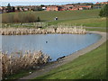

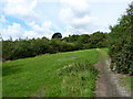
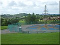
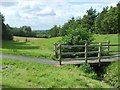
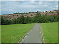
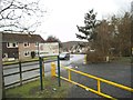

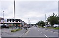
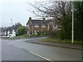
29 photos from this area
Area Information
Key information about the DY1 2SU including its size, population, and administrative classification.
- Area Type
- Postcode
- Area Size
- 7709 m²
- Population
- 1480
- Population Density
- 2056 people/km²
House Prices in DY1 2SU
20
Properties
£180,591
Average Sold Price
£78,000
Lowest Price
£316,750
Highest Price
Showing 20 properties
| Address | Type | Beds | Baths | Last Sale Price | Last Sale Date | |
|---|---|---|---|---|---|---|
| 8 Ludlow Way, Dudley, DY1 2SU | Detached | 3 | 2 | £310,000 | Oct 2023 | |
| 23 Ludlow Way, Dudley, DY1 2SU | house | - | - | £274,000 | Mar 2021 | |
| 2 Ludlow Way, Dudley, DY1 2SU | Detached | 5 | - | £316,750 | Jul 2019 | |
| 10 Ludlow Way, Dudley, DY1 2SU | Detached | 4 | - | £234,950 | Sep 2013 | |
| 9 Ludlow Way, Dudley, DY1 2SU | Detached | 4 | - | £195,000 | Apr 2012 | |
| 4 Ludlow Way, Dudley, DY1 2SU | Detached | - | - | £192,950 | Jan 2007 | |
| 14 Ludlow Way, Dudley, DY1 2SU | Detached | - | - | £114,950 | Oct 2001 | |
| 6 Ludlow Way, Dudley, DY1 2SU | Detached | - | - | £99,950 | Aug 2000 | |
| 7 Ludlow Way, Dudley, DY1 2SU | Detached | - | - | £89,950 | Jul 2000 | |
| 3 Ludlow Way, Dudley, DY1 2SU | Detached | - | - | £78,000 | May 1999 |
Page 1 of 2
Energy Efficiency in DY1 2SU
Amenities
Schools
| Rank | School | Type | Entry gender | Ages |
|---|
Explore more schools in this area
Go to Schools tabDemographics
Household Size
Family (3-5 people)
most common
Accommodation Type
Houses
most common
Tenure
92
majority
Ethnic Group
White
most common
Religion
N/A
most common
Household Composition
N/A
most common
Age
47
median
Adults (30-64 years)
most common
Household Deprivation
N/A
with no deprivation
NS-SEC
39
in Lower managerial occupations
Explore more demographic insights in this area
Go to Demographics tabPlanning
Planning Constraints
- Flood RiskPremium
- Ramsar Wetland SitesPremium
- Area of Outstanding Natural BeautyPremium
- Protected Nature ReservePremium
- Protected WoodlandPremium