Area Overview for DY1 1JQ
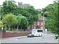
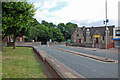
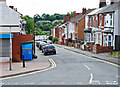
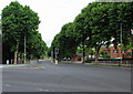
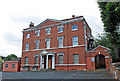
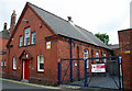
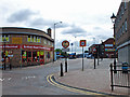
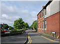
Photos of DY1 1JQ


Area Information
DY1 1JQ is a small, tightly knit residential postcode in England with a population of 1472. The area is characterised by its compact nature, offering a quiet, community-focused environment. Most residents are adults aged 30–64, with a median age of 47, suggesting a mature demographic that values stability. The housing stock here is predominantly flats, reflecting a rental-heavy market where home ownership accounts for just 25% of properties. This dynamic shapes daily life, with a focus on shared spaces and local amenities. The area’s proximity to schools, rail networks, and retail hubs makes it practical for families and commuters. While the population is small, the cluster of services within reach ensures residents have access to essential needs without needing to travel far. The absence of major environmental constraints like protected woodlands or AONB designations means development is relatively unconstrained, though the high crime risk nearby is a notable consideration. For those seeking a manageable, service-rich postcode with a balance of residential and practical infrastructure, DY1 1JQ offers a distinct blend of accessibility and community living.
- Area Type
- Postcode
- Area Size
- Not available
- Population
- 1472
- Population Density
- 3470 people/km²
The property market in DY1 1JQ is heavily rental-focused, with only 25% of homes owned by residents. This low home ownership rate indicates a market where flats are the predominant housing type, likely due to the area’s small size and the suitability of flats for rental purposes. The concentration of flats may also reflect a history of housing developments prioritising high-density living. For buyers, this dynamic suggests that the area is not ideal for long-term investment in owner-occupied properties, as demand is driven by renters rather than homeowners. The limited number of homes and the prevalence of flats mean that the immediate surroundings are likely to mirror this pattern, with few detached or semi-detached properties available. Buyers should consider whether the rental market’s stability aligns with their goals, as the area’s compact nature may limit options for those seeking larger or more traditional housing.
House Prices in DY1 1JQ
No properties found in this postcode.
Energy Efficiency in DY1 1JQ
The lifestyle in DY1 1JQ is shaped by its proximity to a range of amenities. Retail options include Asda Dudley, Heron Dudley, and Iceland Dudley, providing essential shopping and grocery needs. For transport, residents can access five railway stations, such as Tipton and Dudley Port, as well as metro stops like Bradley Lane and Loxdale, which facilitate both local and long-distance travel. These connections make commuting and accessing services straightforward. While the area lacks expansive parks or leisure facilities, the availability of retail and transport hubs ensures daily life is convenient. The mix of shops and transport options reflects a practical, community-oriented approach to living, where accessibility and functionality are prioritised. For those valuing ease of movement and nearby services, DY1 1JQ offers a compact but well-connected environment.
Amenities
Schools
Residents of DY1 1JQ have access to several primary schools, including Jesson’s CofE Primary School (VA), Castle High School and Visual Arts College, The Dudley School, and Jesson’s Church of England Primary School. St James Academy, an academy with an Ofsted rating of ‘good’, adds variety to the educational options available. The presence of both primary schools and an academy suggests a range of teaching approaches and specialisms, which may appeal to families seeking specific curricula or facilities. However, the absence of secondary schools in the immediate area means students may need to travel for further education. The mix of school types indicates a focus on primary education, which aligns with the area’s demographic of working-age adults and families with young children. For those prioritising proximity to schools, the cluster of primary institutions within reach is a practical advantage.
| Rank | School | Type | Entry gender | Ages |
|---|---|---|---|---|
| 1 | Jesson's CofE Primary School (VA) | primary | N/A | N/A |
| 2 | Castle High School and Visual Arts College | primary | N/A | N/A |
| 3 | The Dudley School | primary | N/A | N/A |
| 4 | St James Academy | academy | N/A | N/A |
| 5 | Jesson's Church of England Primary School | primary | N/A | N/A |
Explore more schools in this area
Go to Schools tabDemographics
The community in DY1 1JQ is predominantly composed of adults aged 30–64, with a median age of 47. This suggests a population that is largely established in careers and family life, with fewer young children or retirees. Home ownership is low, at just 25%, indicating that most residents rent their accommodation. The primary housing type is flats, which aligns with the area’s compact nature and the prevalence of rental properties. The predominant ethnic group is White, though no specific data on diversity or deprivation levels is provided. The age profile implies a stable, middle-aged population, which may influence local services and amenities. For instance, schools in the area cater to primary education, reflecting the needs of families with children. The low home ownership rate could suggest a transient population or a focus on rental investment, which may affect the social fabric of the community. Overall, the demographic structure points to a practical, functional postcode tailored to working-age adults.
Household Size
Accommodation Type
Tenure
Ethnic Group
Religion
Household Composition
Age
Household Deprivation
NS-SEC
Explore more demographic insights in this area
Go to Demographics tabPlanning
Planning Constraints
- Flood RiskPremium
- Ramsar Wetland SitesPremium
- Area of Outstanding Natural BeautyPremium
- Protected Nature ReservePremium
- Protected WoodlandPremium
- Crime RiskPremium