Area Overview for Dorridge and Hockley Heath Ward
Photos of Dorridge and Hockley Heath Ward
Area Information
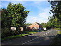
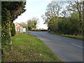
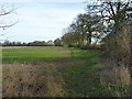
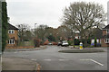
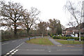
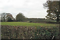
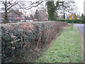
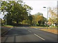
Dorridge and Hockley Heath Ward spans 11.5 km² within the Metropolitan Borough of Solihull, offering a distinct suburban-rural character in West Midlands, England. This area, historically part of Warwickshire, centres on the affluent village of Dorridge and the settlement of Hockley Heath, which incorporates the Nuthurst hamlet. The landscape reflects a blend of 19th-century railway development and ancient woodland origins. You will find Dorridge a few miles north-east of Hockley Heath, connected primarily by Stratford Road. The ward's atmosphere is shaped by local resistance to developers, preserving a quiet village feel rather than rapid urbanisation. Coordinates like 52.377263, -1.744351 near postcode B93 0PX help define the location south-west of Solihull. Life here moves at a deliberate pace, anchored by historic routes and mature settings. The area defined its residential nature with a 2011 population of about 11,140, though specific sub-area figures vary. You are looking at a community where the past meets the present, from Four Ashes trees dating to 1662 to modern estate developments. This ward is not a city fringe but a settled place with deep roots, where the boundary between rural pastures and substantial family homes remains clear. Living in Dorridge and Hockley Heath Ward means choosing an environment where history drives the local character.
- Area Type
- District Borough Unitary Ward
- Area Size
- 11.5 km²
- Population
- Not available
- Population Density
- Not available
Demographics
The community in Dorridge and Hockley Heath Ward presents a clear demographic profile dominated by older residents. The median age stands at 70, indicating a population skewed significantly towards seniors compared to the national average. While specific data on household composition types is not detailed in the current records, the age profile strongly suggests a retirement-heavy demographic. Home ownership is extremely high, with 86% of residents owning their properties outright or with a mortgage, far exceeding typical market rates. This figure reflects a settlement where people often purchase early and stay for life. Accommodation types generally comprise substantial family homes and mansions, often owned by long-term residents. The area does not focus on dense rental blocks or high-density living. Ethnic diversity and religious breakdowns are not the defining features of this specific ward; instead, the community is structured around age and property tenure. This demographic reality shapes daily life, with services and local facilities catering to an older population. The high home ownership rate means that financial turnover is lower than in newer build areas. You can expect find homes in Dorridge that have been in the same families for decades, giving the neighbourhood a stable, established feel.
Household Size
Accommodation Type
Tenure
Ethnic Group
Religion
Household Composition
Age
Household Deprivation
NS-SEC
Explore more demographic insights in this area
Go to Demographics tabPlanning
Planning Constraints
- Flood RiskLocked
- Ramsar Wetland SitesLocked
- Area of Outstanding Natural BeautyLocked
- Protected Nature ReserveLocked
- Protected WoodlandLocked
- Crime RiskLocked