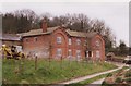
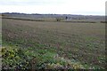
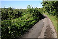
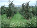
Area Overview for Dormington
Photos of Dormington

Area Information
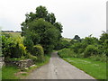
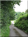
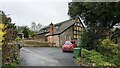
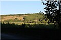
Living in Dormington means settling into a small civil parish that covers just 4.0 km². This compact footprint defines the daily rhythm of life here, where distance to local amenities is minimal. You will find a community character shaped almost entirely by its resident population rather than transient visitors. The area offers a straightforward environment for those who prefer a contained setting over sprawling urban developments. Your walks through the parish will reveal a landscape that prioritises quiet over commercial bustle. The scale of Dormington ensures that neighbours are often within shouting distance, creating an immediate sense of connection between households. Daily life revolves around the immediate surrounding rather than distant city centres. The small size means you do not require extensive travel to access the basic structures of community life. This parson-sized neighbourhood suits those who value proximity to their environment. There are no major industrial zones or large-scale commercial hubs described within this specific boundary. Your morning commute or evening stroll remains localised by design. Dormington presents a singular option for buyers seeking a defined, small-scale rural settlement. The area does not boast vast green belts or complex infrastructure networks, but it delivers a focused residential experience.
- Area Type
- Parish
- Area Size
- 4.0 km²
- Population
- Not available
- Population Density
- Not available
Demographics
The community in Dormington is distinctly skewed towards older residents. The median age stands at 70, indicating a population where life expectancy and retirement age coincide directly with the neighbourhood average. Total household composition data confirms that Age: Total represents the only recorded demographic breakdown available for this parish. When you consider who lives here, the picture is one of long-term residency rather than young families or professional commuters moving in for work. Home ownership levels provide a clear picture of financial stability within the area. Sixty-eight per cent of households own their homes, while the remainder likely rent. This high ownership rate suggests the local economy supports asset retention over long-term renting. Accommodation type data aggregates all housing forms into a single total without distinguishing between detached, semi-detached, or flats. The lack of specific breakdown implies a homogenous stock typical of established rural parishes. Diversity metrics are not explicitly broken out in the current records. Predominant ethnic group, religion, and specific household composition figures remain as total aggregates. This absence of granular diversity data points towards a relatively uniform community make-up. Residents here likely share similar life stages and socioeconomic backgrounds given the age profile. You can expect a stable neighbourly block rather than a rapidly changing demographic mix.
Household Size
Accommodation Type
Tenure
Ethnic Group
Religion
Household Composition
Age
Household Deprivation
NS-SEC
Explore more demographic insights in this area
Go to Demographics tabPlanning
Planning Constraints
- Flood RiskPremium
- Ramsar Wetland SitesPremium
- Area of Outstanding Natural BeautyPremium
- Protected Nature ReservePremium
- Protected WoodlandPremium
- Crime RiskPremium