Area Overview for Dordon
Photos of Dordon


Area Information
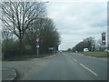
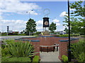
Living in Dordon means settling into a district borough unitary ward defined by practical utility rather than grandeur. This area covers 8.7 km², creating a compact footprint for daily life. You will find a community where the past meets the present, characterised by a median age of 70. Most age groups are represented, though the dominant demographic skews significantly towards older adults. This profile suggests a quiet, established neighbourhood where residents value stability. The area does not boast protected nature reserves or Areas of Outstanding Natural Beauty, and it contains no Ramsar wetland sites. However, you should register on a flood warning service due to low flood risk coverage, which currently registers with a score of 6.14. Security precautions are advisable for all residents, as the crime risk assessment returns a level of warning with a score of 60. This indicates medium crime rates that sit around the national average. Your daily routine will likely involve steady, unhurried commutes within a 60% owner-occupied setting. You are moving into a space that prioritises safety and established routines over high-energy development.
- Area Type
- District Borough Unitary Ward
- Area Size
- 8.7 km²
- Population
- Not available
- Population Density
- Not available
Demographics
The community in Dordon reflects a mature settlement with a median age of 70. This figure indicates that the population is predominantly composed of older adults, likely retirees looking for peace and quiet. While specific data on ethnic diversity, religion, and detailed household composition is not provided in the profile, the age skewing is a defining feature of local life. You should expect a neighbourhood where community events often cater to older generations. Home ownership stands at 60%, a figure that signals a stable, long-term resident base rather than a transient rental market. This high level of ownership supports local shopkeepers and creates a predictable community dynamic. Accommodation types vary, but the ownership rate suggests many homes have been in families for generations. Deprivation levels are not highlighted in the available figures, implying a community that functions on standard economic terms. Residents here appreciate the lack of planning constraints related to protected woodlands, though this constraint does exist in the area with a score of 0.49. The demographic reality is one of age and stability rather than rapid growth or youth-driven change.
Household Size
Accommodation Type
Tenure
Ethnic Group
Religion
Household Composition
Age
Household Deprivation
NS-SEC
Explore more demographic insights in this area
Go to Demographics tabPlanning
Planning Constraints
- Flood RiskPremium
- Ramsar Wetland SitesPremium
- Area of Outstanding Natural BeautyPremium
- Protected Nature ReservePremium
- Protected WoodlandPremium
- Crime RiskPremium