Area Overview for Defford
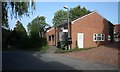
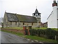
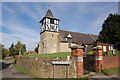
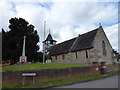
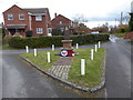
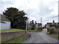
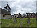
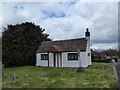
Photos of Defford


Area Information
Defford is a compact built-up area in England, spanning 30.2 hectares. Its small size means it is not a sprawling town but a tight-knit community. The area’s population is predominantly older, with a median age of 70, suggesting a demographic skewed towards retirees and long-term residents. Daily life in Defford is characterised by proximity to essential services, with five retail outlets within practical reach, including Asda Strensham and Spar stores. The area’s rail connectivity is notable, with three stations—Pershore, Worcestershire Parkway, and Ashchurch for Tewkesbury—offering links to nearby towns and cities. For families, the Defford-Cum-Besford CofE School provides a primary education option with a ‘good’ Ofsted rating. While Defford lacks the density of larger urban areas, its charm lies in its simplicity: a quiet, low-crime environment with access to basic amenities. This makes it appealing to those prioritising safety, convenience, and a slower pace of life over bustling urban centres. Living here means embracing a lifestyle where practicality and community are central.
- Area Type
- Built Up Area 250
- Area Size
- 30.2 hectares
- Population
- Not available
- Population Density
- Not available
Defford’s lifestyle is shaped by its proximity to essential retail and transport hubs. Five retail outlets, including Asda Strensham and Spar stores, provide access to groceries, fuel, and everyday necessities. The three nearby railway stations—Pershore, Worcestershire Parkway, and Ashchurch for Tewkesbury—offer regular services to larger towns, enabling residents to access more extensive shopping, healthcare, and cultural opportunities beyond the immediate area. While the data does not mention parks or leisure facilities, the presence of these retail and transport options suggests a community focused on practicality. For residents, daily life involves a balance between local convenience and reliance on nearby towns for more specialised services. The area’s compact nature means that amenities are within walking or short driving distance, reinforcing a lifestyle that prioritises ease of access over expansive recreational spaces.
Amenities
Schools
The nearest school to Defford is the Defford-Cum-Besford CofE School, a primary institution with a ‘good’ Ofsted rating. This school serves the immediate area, providing education for children up to the age of 11. The absence of secondary schools in the data suggests that families may need to travel to nearby towns for higher education. The presence of a primary school with a positive rating is a key consideration for parents seeking a reliable foundation for their children’s schooling. However, the lack of additional educational institutions in the data means that Defford is not a destination for those requiring a full range of school options. For families, this implies that proximity to a well-regarded primary school is a strength, but the area may not be ideal for those needing immediate access to secondary education.
| Rank | A + A* % | School | Type | Entry gender | Ages |
|---|---|---|---|---|---|
| 1 | N/A | Defford-Cum-Besford CofE School | primary | N/A | N/A |
Explore more schools in this area
Go to Schools tabDemographics
Defford’s population is overwhelmingly composed of individuals aged 70 and above, with the median age reflecting a community dominated by older adults. This demographic profile suggests a settlement where retirement is the primary life stage. Home ownership is high, at 83%, indicating a stable, long-term resident base with little turnover. The data does not specify household composition or accommodation types, but the high ownership rate implies a mix of owner-occupied homes, likely including semi-detached or detached properties typical of smaller towns. The area’s demographic homogeneity is evident in the absence of detailed information on ethnic diversity or religious composition, which may reflect a lack of significant variation in these categories. For residents, this means a community with shared life experiences and needs, particularly around healthcare and leisure. The low crime risk score of 82 further supports the idea of a secure, predictable environment. However, the lack of data on deprivation or income levels means that the quality of life for residents cannot be fully assessed without additional context.
Household Size
Accommodation Type
Tenure
Ethnic Group
Religion
Household Composition
Age
Household Deprivation
NS-SEC
Explore more demographic insights in this area
Go to Demographics tabPlanning
Planning Constraints
- Crime RiskLocked