Area Overview for DE15 9DU
Photos of DE15 9DU
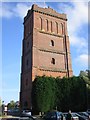

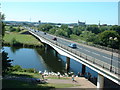


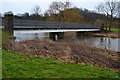

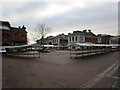
100 photos from this area
Area Information
Key information about the DE15 9DU including its size, population, and administrative classification.
- Area Type
- Postcode
- Area Size
- 3.4 hectares
- Population
- 1778
- Population Density
- 4337 people/km²
House Prices in DE15 9DU
63
Properties
£187,897
Average Sold Price
£29,950
Lowest Price
£655,000
Highest Price
Showing 63 properties
| Address | Type | Beds | Baths | Last Sale Price | Last Sale Date | |
|---|---|---|---|---|---|---|
| 34 Spring Terrace Road, Stapenhill, Burton Upon Trent, DE15 9DU | Detached | 3 | 1 | £358,000 | Oct 2025 | |
| 11 Spring Terrace Road, Stapenhill, Burton Upon Trent, DE15 9DU | Terraced | 2 | 1 | £155,000 | May 2025 | |
| 5 Spring Terrace Road, Stapenhill, Burton Upon Trent, DE15 9DU | house | 3 | - | £168,000 | Apr 2025 | |
| Olwen House, 56 Spring Terrace Road, Stapenhill, Burton Upon Trent, DE15 9DU | Detached | 4 | 2 | £655,000 | Aug 2024 | |
| 8 Spring Terrace Road, Stapenhill, Burton Upon Trent, DE15 9DU | house | 3 | - | £160,000 | Jul 2024 | |
| 10 Spring Terrace Road, Stapenhill, Burton Upon Trent, DE15 9DU | Terraced | 2 | 1 | £155,000 | Apr 2024 | |
| 74 Spring Terrace Road, Stapenhill, Burton Upon Trent, DE15 9DU | Terraced | 3 | 1 | £174,000 | Jan 2024 | |
| Springfield House, 81 Spring Terrace Road, Stapenhill, Burton Upon Trent, DE15 9DU | Semi-detached | 4 | 1 | £270,000 | Oct 2023 | |
| 67 Spring Terrace Road, Stapenhill, Burton Upon Trent, DE15 9DU | Detached | 3 | 1 | £265,000 | Mar 2023 | |
| 55 Spring Terrace Road, Stapenhill, Burton Upon Trent, DE15 9DU | house | - | - | £438,000 | Sep 2022 |
Page 1 of 7
Energy Efficiency in DE15 9DU
Amenities
Schools
| Rank | School | Type | Entry gender | Ages |
|---|
Explore more schools in this area
Go to Schools tabDemographics
Household Size
One person
most common
Accommodation Type
Houses
most common
Tenure
58
majority
Ethnic Group
White
most common
Religion
N/A
most common
Household Composition
N/A
most common
Age
47
median
Adults (30-64 years)
most common
Household Deprivation
N/A
with no deprivation
NS-SEC
23
in Lower managerial occupations
Explore more demographic insights in this area
Go to Demographics tabPlanning
Planning Constraints
- Flood RiskPremium
- Ramsar Wetland SitesPremium
- Area of Outstanding Natural BeautyPremium
- Protected Nature ReservePremium
- Protected WoodlandPremium