Area Overview for DE15 0ZL
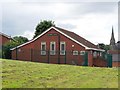
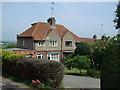
Photos of DE15 0ZL


Area Information
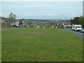
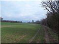
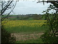
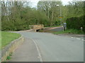
Living in DE15 0ZL means being part of a small, tightly knit residential cluster in England, home to 1,657 people. This postcode area is characterised by its modest scale and proximity to essential services. The community is predominantly composed of adults aged 30–64, with a median age of 47, suggesting a mature, stable population. The area’s housing stock consists largely of individual homes, reflecting a quieter, more private lifestyle. Residents benefit from nearby primary schools, including Tower View Primary School, which holds a ‘good’ Ofsted rating, and accessible rail links such as Burton and Willington stations. While the area lacks large-scale amenities, its compact size ensures a sense of familiarity. Digital connectivity is strong, with broadband and mobile scores above 80, supporting remote work and daily internet use. The low flood risk and absence of environmental constraints make it a practical choice for those prioritising safety and planning certainty. For buyers seeking a peaceful, well-connected small community, DE15 0ZL offers a blend of simplicity and convenience.
- Area Type
- Postcode
- Area Size
- Not available
- Population
- 1657
- Population Density
- 5017 people/km²
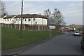
The property market in DE15 0ZL is defined by its low home ownership rate of 31% and a housing stock dominated by individual homes. This suggests that the area is not a major hub for owner-occupation, with a higher proportion of rental properties. The prevalence of houses over flats or apartments indicates a quieter, more private living environment, suitable for those seeking space and seclusion. However, the small population and limited housing stock mean the market is unlikely to be highly competitive. Buyers should consider that the area’s compact size may restrict property choice, though the absence of planning constraints such as AONB or protected woodlands could simplify development or renovation. For those prioritising a low-maintenance, low-density lifestyle, DE15 0ZL offers a niche opportunity. However, the lower home ownership rate may reflect limited demand or a focus on long-term rentals rather than investment.
House Prices in DE15 0ZL
No properties found in this postcode.
Energy Efficiency in DE15 0ZL
The lifestyle in DE15 0ZL is shaped by its proximity to essential retail and transport hubs. Within practical reach are five retail outlets, including Co-op Winshill, Spar Platinum, and Tesco Stapenhill, offering everyday shopping and convenience. These stores cater to local needs, reducing the necessity for long journeys to larger centres. The area’s three rail stations—Burton, Willington, and Tutbury & Hatton—provide access to regional services, though the absence of major leisure or dining venues means residents may need to travel for entertainment. The compact nature of the area fosters a self-contained lifestyle, with amenities focused on practicality rather than diversity. While the retail options are sufficient for daily needs, the lack of parks or recreational facilities suggests a community oriented around simplicity and functional living.
Amenities
Schools
Residents of DE15 0ZL have access to two primary schools: Joseph Clark Junior School and Tower View Primary School, both of which serve the local community. Tower View Primary School holds a ‘good’ Ofsted rating, indicating a satisfactory standard of education. The presence of two primary schools provides families with options for their children’s early education, though no secondary schools are listed in the area. This suggests that students may need to travel to nearby towns for secondary education. The mix of schools reflects a focus on foundational learning, but the lack of higher-level educational facilities nearby could be a consideration for families planning long-term in the area. The quality of primary education, however, is a clear strength, with one school demonstrating a commendable performance.
| Rank | School | Type | Entry gender | Ages |
|---|
Explore more schools in this area
Go to Schools tabDemographics
The community in DE15 0ZL is predominantly composed of adults aged 30–64, with a median age of 47. This suggests a population that is largely settled, with fewer young families or elderly residents compared to other areas. Home ownership here is relatively low, at 31%, indicating that a significant portion of the housing stock is rented. The area is characterised by houses rather than flats or apartments, which aligns with its residential, low-density profile. The predominant ethnic group is White, reflecting a homogenous demographic. While no specific data on deprivation is provided, the combination of modest home ownership and a mature age profile may imply a community with stable, long-term residents. However, the absence of detailed socioeconomic indicators means broader conclusions about quality of life remain unverified. The area’s small size and focused demographics create a distinct local identity, shaped by its limited population and housing type.
Household Size
Accommodation Type
Tenure
Ethnic Group
Religion
Household Composition
Age
Household Deprivation
NS-SEC
Explore more demographic insights in this area
Go to Demographics tabPlanning
Planning Constraints
- Flood RiskPremium
- Ramsar Wetland SitesPremium
- Area of Outstanding Natural BeautyPremium
- Protected Nature ReservePremium
- Protected WoodlandPremium