Area Overview for DE15 0DX
Photos of DE15 0DX
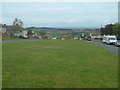


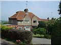
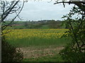

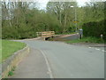
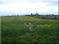
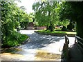
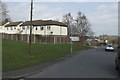
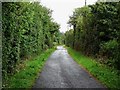

14 photos from this area
Area Information
Key information about the DE15 0DX including its size, population, and administrative classification.
- Area Type
- Postcode
- Area Size
- 5.7 hectares
- Population
- 1791
- Population Density
- 2723 people/km²
House Prices in DE15 0DX
43
Properties
£156,747
Average Sold Price
£29,000
Lowest Price
£285,000
Highest Price
Showing 43 properties
| Address | Type | Beds | Baths | Last Sale Price | Last Sale Date | |
|---|---|---|---|---|---|---|
| 9 Wheatley Lane, Winshill, Burton Upon Trent, DE15 0DX | house | - | - | £190,000 | Mar 2023 | |
| 113 Wheatley Lane, Winshill, Burton Upon Trent, DE15 0DX | house | 3 | - | £250,000 | Jun 2022 | |
| 10 Wheatley Lane, Winshill, Burton Upon Trent, DE15 0DX | Semi-detached | 4 | 2 | £236,000 | Feb 2021 | |
| 114 Wheatley Lane, Winshill, Burton Upon Trent, DE15 0DX | Semi-detached | 3 | 1 | £184,950 | Sep 2020 | |
| 111A Wheatley Lane, Winshill, Burton Upon Trent, DE15 0DX | Detached | 4 | 1 | £230,000 | Feb 2020 | |
| 120 Wheatley Lane, Winshill, Burton Upon Trent, DE15 0DX | Bungalow | 2 | 1 | £182,500 | Dec 2019 | |
| 18 Wheatley Lane, Winshill, Burton Upon Trent, DE15 0DX | house | 3 | 2 | £155,000 | Jun 2018 | |
| 70 Wheatley Lane, Winshill, Burton Upon Trent, DE15 0DX | house | - | - | £236,501 | May 2017 | |
| 4 Wheatley Lane, Winshill, Burton Upon Trent, DE15 0DX | Semi-detached | 3 | 1 | £130,000 | Jul 2016 | |
| 20 Wheatley Lane, Winshill, Burton Upon Trent, DE15 0DX | Detached | 4 | 2 | £285,000 | Mar 2015 |
Page 1 of 5
Energy Efficiency in DE15 0DX
Amenities
Schools
| Rank | School | Type | Entry gender | Ages |
|---|
Explore more schools in this area
Go to Schools tabDemographics
Household Size
Two person
most common
Accommodation Type
Houses
most common
Tenure
82
majority
Ethnic Group
White
most common
Religion
N/A
most common
Household Composition
N/A
most common
Age
47
median
Adults (30-64 years)
most common
Household Deprivation
N/A
with no deprivation
NS-SEC
33
in Lower managerial occupations
Explore more demographic insights in this area
Go to Demographics tabPlanning
Planning Constraints
- Flood RiskPremium
- Ramsar Wetland SitesPremium
- Area of Outstanding Natural BeautyPremium
- Protected Nature ReservePremium
- Protected WoodlandPremium