Area Overview for DE15 0AF
Photos of DE15 0AF
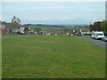
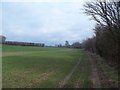
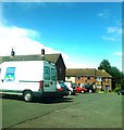
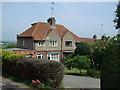
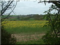
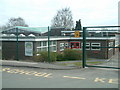
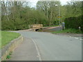
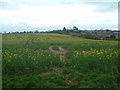
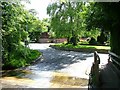
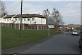
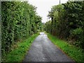
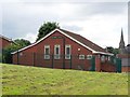
14 photos from this area
Area Information
Key information about the DE15 0AF including its size, population, and administrative classification.
- Area Type
- Postcode
- Area Size
- 3617 m²
- Population
- 1657
- Population Density
- 5017 people/km²
House Prices in DE15 0AF
14
Properties
£124,912
Average Sold Price
£90,000
Lowest Price
£159,000
Highest Price
Showing 14 properties
| Address | Type | Beds | Baths | Last Sale Price | Last Sale Date | |
|---|---|---|---|---|---|---|
| 10 Cherry Tree Gardens, Winshill, Burton Upon Trent, DE15 0AF | Terraced | 3 | 1 | £142,000 | Jan 2024 | |
| 9 Cherry Tree Gardens, Winshill, Burton Upon Trent, DE15 0AF | Terraced | 3 | 1 | £159,000 | Jul 2023 | |
| 8 Cherry Tree Gardens, Winshill, Burton Upon Trent, DE15 0AF | house | - | - | £145,000 | Nov 2021 | |
| 14 Cherry Tree Gardens, Winshill, Burton Upon Trent, DE15 0AF | house | 3 | - | £148,000 | Sep 2021 | |
| 1 Cherry Tree Gardens, Winshill, Burton Upon Trent, DE15 0AF | Maisonette | 2 | - | £120,000 | Mar 2021 | |
| 7 Cherry Tree Gardens, Winshill, Burton Upon Trent, DE15 0AF | Terraced | 3 | 2 | £137,500 | Aug 2020 | |
| 12 Cherry Tree Gardens, Winshill, Burton Upon Trent, DE15 0AF | house | - | - | £105,000 | Jun 2014 | |
| 5 Cherry Tree Gardens, Winshill, Burton Upon Trent, DE15 0AF | Terraced | 3 | 2 | £124,999 | Feb 2013 | |
| 15 Cherry Tree Gardens, Winshill, Burton Upon Trent, DE15 0AF | Terraced | 3 | - | £99,000 | Nov 2012 | |
| 3 Cherry Tree Gardens, Winshill, Burton Upon Trent, DE15 0AF | Flat | - | - | £90,000 | Jul 2011 |
Page 1 of 2
Energy Efficiency in DE15 0AF
Amenities
Schools
| Rank | School | Type | Entry gender | Ages |
|---|
Explore more schools in this area
Go to Schools tabDemographics
Household Size
One person
most common
Accommodation Type
Houses
most common
Tenure
31
majority
Ethnic Group
White
most common
Religion
N/A
most common
Household Composition
N/A
most common
Age
47
median
Adults (30-64 years)
most common
Household Deprivation
N/A
with no deprivation
NS-SEC
16
in Lower managerial occupations
Explore more demographic insights in this area
Go to Demographics tabPlanning
Planning Constraints
- Flood RiskPremium
- Ramsar Wetland SitesPremium
- Area of Outstanding Natural BeautyPremium
- Protected Nature ReservePremium
- Protected WoodlandPremium