Area Overview for DE14 3GW
Photos of DE14 3GW
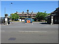

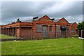
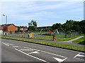
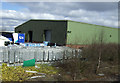
9 photos from this area
Area Information
Key information about the DE14 3GW including its size, population, and administrative classification.
- Area Type
- Postcode
- Area Size
- 7035 m²
- Population
- 1722
- Population Density
- 1388 people/km²
House Prices in DE14 3GW
14
Properties
£154,102
Average Sold Price
£85,995
Lowest Price
£295,000
Highest Price
Showing 14 properties
| Address | Type | Beds | Baths | Last Sale Price | Last Sale Date | |
|---|---|---|---|---|---|---|
| 3 Haydock Close, Branston, DE14 3GW | house | - | - | £295,000 | Apr 2021 | |
| 19 Haydock Close, Branston, DE14 3GW | Detached | 4 | 2 | £232,500 | Aug 2015 | |
| 5 Haydock Close, Branston, DE14 3GW | Detached | - | - | £192,950 | Dec 2004 | |
| 1 Haydock Close, Branston, DE14 3GW | Detached | - | - | £175,000 | Sep 2004 | |
| 11 Haydock Close, Branston, DE14 3GW | Detached | - | - | £187,500 | Sep 2004 | |
| 9 Haydock Close, Branston, DE14 3GW | Detached | 4 | 3 | £175,000 | Feb 2003 | |
| 15 Haydock Close, Branston, DE14 3GW | Detached | - | - | £183,000 | Jan 2003 | |
| 6 Haydock Close, Branston, DE14 3GW | Detached | - | - | £97,000 | Feb 2002 | |
| 7 Haydock Close, Branston, DE14 3GW | Detached | 4 | 1 | £127,000 | Jun 2001 | |
| 2 Haydock Close, Branston, DE14 3GW | Detached | - | - | £99,995 | May 1998 |
Page 1 of 2
Energy Efficiency in DE14 3GW
Amenities
Schools
| Rank | School | Type | Entry gender | Ages |
|---|
Explore more schools in this area
Go to Schools tabDemographics
Household Size
Two person
most common
Accommodation Type
Houses
most common
Tenure
73
majority
Ethnic Group
White
most common
Religion
N/A
most common
Household Composition
N/A
most common
Age
47
median
Adults (30-64 years)
most common
Household Deprivation
N/A
with no deprivation
NS-SEC
30
in Lower managerial occupations
Explore more demographic insights in this area
Go to Demographics tabPlanning
Planning Constraints
- Flood RiskPremium
- Ramsar Wetland SitesPremium
- Area of Outstanding Natural BeautyPremium
- Protected Nature ReservePremium
- Protected WoodlandPremium