Area Overview for DE14 3DZ
Photos of DE14 3DZ
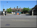
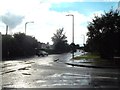
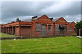
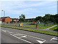
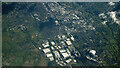
9 photos from this area
Area Information
Key information about the DE14 3DZ including its size, population, and administrative classification.
- Area Type
- Postcode
- Area Size
- 1.4 hectares
- Population
- 1653
- Population Density
- 4230 people/km²
House Prices in DE14 3DZ
31
Properties
£205,622
Average Sold Price
£75,500
Lowest Price
£325,000
Highest Price
Showing 31 properties
| Address | Type | Beds | Baths | Last Sale Price | Last Sale Date | |
|---|---|---|---|---|---|---|
| 9 Newman Drive, Branston, DE14 3DZ | Detached | 4 | 3 | £325,000 | Sep 2025 | |
| 20 Newman Drive, Branston, DE14 3DZ | Detached | 4 | 2 | £290,000 | Oct 2023 | |
| 25 Newman Drive, Branston, DE14 3DZ | Detached | 3 | 2 | £255,000 | Feb 2023 | |
| 3 Newman Drive, Branston, DE14 3DZ | Retail | 4 | 2 | £320,000 | Oct 2022 | |
| 10 Newman Drive, Branston, DE14 3DZ | house | - | - | £276,000 | Jan 2022 | |
| 5 Newman Drive, Branston, DE14 3DZ | house | 3 | - | £237,000 | May 2021 | |
| 2 Newman Drive, Branston, DE14 3DZ | house | - | - | £235,000 | Jan 2020 | |
| 26 Newman Drive, Branston, DE14 3DZ | house | - | - | £242,000 | Nov 2017 | |
| 27 Newman Drive, Branston, DE14 3DZ | Detached | 3 | - | £179,000 | Nov 2016 | |
| 18 Newman Drive, Branston, DE14 3DZ | Detached | 4 | - | £230,000 | Aug 2014 |
Page 1 of 4
Energy Efficiency in DE14 3DZ
Amenities
Schools
| Rank | School | Type | Entry gender | Ages |
|---|
Explore more schools in this area
Go to Schools tabDemographics
Household Size
Family (3-5 people)
most common
Accommodation Type
Houses
most common
Tenure
78
majority
Ethnic Group
White
most common
Religion
N/A
most common
Household Composition
N/A
most common
Age
47
median
Adults (30-64 years)
most common
Household Deprivation
N/A
with no deprivation
NS-SEC
37
in Lower managerial occupations
Explore more demographic insights in this area
Go to Demographics tabPlanning
Planning Constraints
- Flood RiskPremium
- Ramsar Wetland SitesPremium
- Area of Outstanding Natural BeautyPremium
- Protected Nature ReservePremium
- Protected WoodlandPremium