Area Overview for DE14 2HT
Photos of DE14 2HT

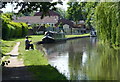
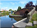
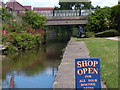
100 photos from this area
Area Information
Key information about the DE14 2HT including its size, population, and administrative classification.
- Area Type
- Postcode
- Area Size
- 1.1 hectares
- Population
- 1891
- Population Density
- 1988 people/km²
House Prices in DE14 2HT
51
Properties
£122,027
Average Sold Price
£19,000
Lowest Price
£255,000
Highest Price
Showing 51 properties
| Address | Type | Beds | Baths | Last Sale Price | Last Sale Date | |
|---|---|---|---|---|---|---|
| 348 Shobnall Street, Burton Upon Trent, DE14 2HT | house | - | - | £170,000 | Mar 2025 | |
| 350 Shobnall Street, Burton Upon Trent, DE14 2HT | Semi-detached | 1 | 1 | £255,000 | Sep 2024 | |
| 338 Shobnall Street, Burton Upon Trent, DE14 2HT | house | - | - | £150,000 | Mar 2024 | |
| 349 Shobnall Street, Burton Upon Trent, DE14 2HT | Detached | 3 | 2 | £177,000 | Oct 2022 | |
| 358 Shobnall Street, Burton Upon Trent, DE14 2HT | Terraced | 1 | - | £155,000 | Jul 2021 | |
| 351 Shobnall Street, Burton Upon Trent, DE14 2HT | house | - | - | £137,950 | Apr 2021 | |
| 355 Shobnall Street, Burton Upon Trent, DE14 2HT | Terraced | 3 | 1 | £130,000 | Jul 2020 | |
| 369 Shobnall Street, Burton Upon Trent, DE14 2HT | Terraced | 3 | 1 | £152,000 | Mar 2019 | |
| Bessie Brown Residential Home, 330 Shobnall Street, Burton Upon Trent, DE14 2HT | Semi-detached | 5 | 1 | £180,000 | Jun 2017 | |
| 373 Shobnall Street, Burton Upon Trent, DE14 2HT | Detached | 4 | 2 | £165,000 | Jul 2016 |
Page 1 of 6
Energy Efficiency in DE14 2HT
Amenities
Schools
| Rank | School | Type | Entry gender | Ages |
|---|
Explore more schools in this area
Go to Schools tabDemographics
Household Size
One person
most common
Accommodation Type
Houses
most common
Tenure
44
majority
Ethnic Group
White
most common
Religion
N/A
most common
Household Composition
N/A
most common
Age
47
median
Adults (30-64 years)
most common
Household Deprivation
N/A
with no deprivation
NS-SEC
14
in Lower managerial occupations
Explore more demographic insights in this area
Go to Demographics tabPlanning
Planning Constraints
- Flood RiskPremium
- Ramsar Wetland SitesPremium
- Area of Outstanding Natural BeautyPremium
- Protected Nature ReservePremium
- Protected WoodlandPremium