Area Overview for DE14 2BD
Photos of DE14 2BD
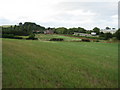
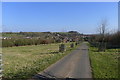
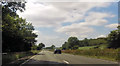

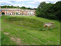

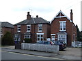
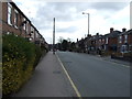
26 photos from this area
Area Information
Key information about the DE14 2BD including its size, population, and administrative classification.
- Area Type
- Postcode
- Area Size
- 2.4 hectares
- Population
- 2181
- Population Density
- 1344 people/km²
House Prices in DE14 2BD
48
Properties
£111,755
Average Sold Price
£34,700
Lowest Price
£185,000
Highest Price
Showing 48 properties
| Address | Type | Beds | Baths | Last Sale Price | Last Sale Date | |
|---|---|---|---|---|---|---|
| 184 Shobnall Road, Burton Upon Trent, DE14 2BD | Terraced | 3 | 1 | £138,816 | May 2025 | |
| 172 Shobnall Road, Burton Upon Trent, DE14 2BD | Terraced | 2 | 1 | £159,950 | Jul 2024 | |
| 164 Shobnall Road, Burton Upon Trent, DE14 2BD | house | - | - | £162,500 | May 2024 | |
| 156 Shobnall Road, Burton Upon Trent, DE14 2BD | Terraced | 3 | 2 | £175,000 | Aug 2023 | |
| 180 Shobnall Road, Burton Upon Trent, DE14 2BD | Terraced | 3 | 1 | £165,000 | Jun 2023 | |
| 155 Shobnall Road, Burton Upon Trent, DE14 2BD | house | - | - | £110,000 | Feb 2023 | |
| 178 Shobnall Road, Burton Upon Trent, DE14 2BD | house | - | - | £159,000 | Jun 2022 | |
| 154 Shobnall Road, Burton Upon Trent, DE14 2BD | Terraced | 3 | 1 | £150,000 | Jun 2022 | |
| 157 Shobnall Road, Burton Upon Trent, DE14 2BD | Terraced | 4 | 1 | £135,000 | Apr 2021 | |
| 190 Shobnall Road, Burton Upon Trent, DE14 2BD | Terraced | 3 | 1 | £127,000 | Sep 2019 |
Page 1 of 5
Energy Efficiency in DE14 2BD
Amenities
Schools
| Rank | School | Type | Entry gender | Ages |
|---|
Explore more schools in this area
Go to Schools tabDemographics
Household Size
Family (3-5 people)
most common
Accommodation Type
Houses
most common
Tenure
65
majority
Ethnic Group
White
most common
Religion
N/A
most common
Household Composition
N/A
most common
Age
47
median
Adults (30-64 years)
most common
Household Deprivation
N/A
with no deprivation
NS-SEC
27
in Lower managerial occupations
Explore more demographic insights in this area
Go to Demographics tabPlanning
Planning Constraints
- Flood RiskPremium
- Ramsar Wetland SitesPremium
- Area of Outstanding Natural BeautyPremium
- Protected Nature ReservePremium
- Protected WoodlandPremium