Area Overview for DE14 1PR
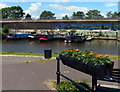
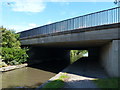
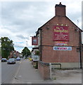
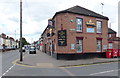
Photos of DE14 1PR


Area Information
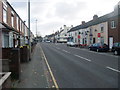
Living in DE14 1PR means inhabiting a compact residential cluster in England, where 1,432 people reside across a densely populated area of 1.39 km². This postcode is defined by its small-scale character, with homes predominantly in the form of houses rather than flats. The area’s demographic profile is shaped by a median age of 47, with the majority of residents falling into the 30-64 age bracket. Daily life here is likely to revolve around local amenities, community interactions, and proximity to transport links. The area’s compact nature means residents are within practical reach of essential services, though the high population density may influence the pace of life. With no major natural or planning constraints, the area offers a straightforward living environment, though the high crime risk is a notable factor. For those seeking a quiet, residential setting with access to nearby towns and transport, DE14 1PR presents a specific, if modest, proposition.
- Area Type
- Postcode
- Area Size
- Not available
- Population
- 1432
- Population Density
- 1032 people/km²
The property market in DE14 1PR is characterised by a low home ownership rate of 26%, suggesting that the area is more rental-focused than owner-occupied. This statistic indicates that the housing stock is likely to be managed by landlords or private investors rather than long-term residents. The predominant accommodation type is houses, which contrasts with areas where flats or apartments are more common. For buyers, this dynamic may present challenges: the limited number of owner-occupied properties could mean fewer opportunities to purchase homes outright, and the market may be more competitive for those seeking to buy. The small size of the area also means that property choices are limited to the immediate cluster, with little scope for expansion. Prospective buyers should consider the rental market’s stability and the potential for future value growth in a setting where ownership is not the norm.
House Prices in DE14 1PR
No properties found in this postcode.
Energy Efficiency in DE14 1PR
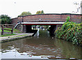
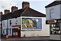
The lifestyle in DE14 1PR is supported by a range of local amenities within practical reach. Retail options include Sainsburys Burton, Aldi Burton, and Co-op Eton, providing essential shopping and grocery needs. These stores cater to daily requirements, reducing the need for long trips to larger centres. The rail network, with stations at Burton, Willington, and Tutbury & Hatton, enhances mobility, allowing residents to access cultural, professional, and recreational opportunities in nearby towns. While the area lacks detailed information on parks or leisure facilities, the presence of these retail and transport links suggests a community focused on practicality and connectivity. The compact nature of the area means that residents can access these amenities without significant travel, contributing to a lifestyle that balances convenience with the limitations of a small postcode cluster.
Amenities
Schools
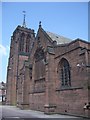
The nearest school to DE14 1PR is Christ Church Primary School, which serves the local community with a primary education offering. The school holds an Ofsted rating of ‘good’, indicating a satisfactory standard of teaching and facilities. As the only named school in the data, it suggests that families in the area may rely on this single primary institution for their children’s early education. The absence of secondary schools or additional educational institutions within the immediate vicinity means that students may need to travel to nearby towns for higher-level schooling. This could influence decisions about where to live, particularly for families with children requiring a full range of educational options. The ‘good’ rating, however, provides a baseline of reliability for parents seeking a stable and adequately resourced primary school.
| Rank | School | Type | Entry gender | Ages |
|---|
Explore more schools in this area
Go to Schools tabDemographics
The community in DE14 1PR is predominantly composed of adults aged 30-64, with a median age of 47. This suggests a mature population, likely with established careers and families. Home ownership is relatively low at 26%, indicating that a significant proportion of residents are likely to be renting. The accommodation type is primarily houses, which contrasts with areas where flats dominate. The predominant ethnic group is White, though no further breakdown of diversity is provided. The low home ownership rate may reflect a rental market dynamic, potentially influenced by local employment patterns or housing availability. While no data on deprivation is explicitly stated, the demographic profile suggests a community that may prioritise stability over mobility, with residents potentially working in nearby towns or cities. The age distribution also implies a population that may be nearing retirement, which could shape local services and amenities.
Household Size
Accommodation Type
Tenure
Ethnic Group
Religion
Household Composition
Age
Household Deprivation
NS-SEC
Explore more demographic insights in this area
Go to Demographics tabPlanning
Planning Constraints
- Flood RiskPremium
- Ramsar Wetland SitesPremium
- Area of Outstanding Natural BeautyPremium
- Protected Nature ReservePremium
- Protected WoodlandPremium