Area Overview for DE14 1HD
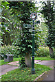
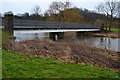
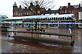
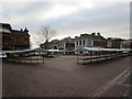
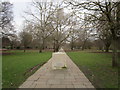
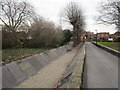
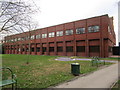
Photos of DE14 1HD

Area Information
Living in DE14 1HD offers a compact, residential experience shaped by its small population of 1,432 and a population density of 1,032 people per square kilometre. This postcode area is a tight-knit cluster of homes, primarily occupied by adults aged 30–64, with a median age of 47. The community is defined by its proximity to local amenities, including three rail stations and a selection of retail outlets. While the area is small, it is well-connected to Burton and surrounding towns via rail links. Daily life here balances suburban tranquillity with practical access to services. The broadband score of 74 and mobile coverage of 84 ensure reliable digital connectivity, supporting remote work and everyday internet use. However, the area’s safety profile is mixed: while flood risk is negligible, crime rates are above average, necessitating caution. For those seeking a quiet, family-oriented setting with nearby transport and shops, DE14 1HD provides a distinct, if modest, living environment.
- Area Type
- Postcode
- Area Size
- Not available
- Population
- 1432
- Population Density
- 1032 people/km²
The property market in DE14 1HD is characterised by a low home ownership rate of 26%, indicating that most residents rent their homes. The accommodation type is primarily houses, which contrasts with areas dominated by flats or apartments. This suggests a housing stock that prioritises single-family dwellings, potentially appealing to families or individuals seeking more space. However, the small size of the area and the limited data on property types mean the market is not extensive. Buyers should consider that the area’s compact nature may limit options, though the presence of nearby rail stations and retail amenities could enhance its appeal. For those seeking a home in DE14 1HD, the focus is likely on existing properties rather than new developments, with the rental market playing a central role in the local economy.
House Prices in DE14 1HD
No properties found in this postcode.
Energy Efficiency in DE14 1HD
The lifestyle in DE14 1HD is shaped by its proximity to local amenities, including five retail outlets such as M&S Burton, Farmfoods Burton, and Iceland Burton. These shops provide everyday essentials, contributing to a self-contained shopping experience. The area’s rail stations offer access to broader networks, enhancing mobility for leisure or commuting. While the data does not mention parks or leisure facilities, the presence of nearby retail and transport options suggests a practical, community-focused lifestyle. The compact nature of DE14 1HD means amenities are within walking or short driving distance, fostering a sense of convenience. However, the lack of specific details on green spaces or recreational facilities leaves gaps in understanding the full range of lifestyle offerings. For residents, the balance of local shops, rail links, and digital connectivity defines daily life in this small postcode area.
Amenities
Schools
The nearest school to DE14 1HD is Christ Church Primary School, which holds an Ofsted rating of ‘good’. This institution serves the primary education needs of the area, though no secondary schools are listed in the data. The absence of higher education facilities means families may need to look beyond DE14 1HD for secondary schooling. The presence of a primary school with a positive rating is a key consideration for parents, offering a local option for younger children. However, the limited range of educational institutions highlights the area’s small scale, which may not cater to all stages of a child’s schooling. For families prioritising proximity to schools, Christ Church Primary School is a notable asset, but further research into secondary options is essential.
| Rank | School | Type | Entry gender | Ages |
|---|
Explore more schools in this area
Go to Schools tabDemographics
The population of DE14 1HD is predominantly adults aged 30–64, with a median age of 47. Only 26% of residents own their homes, suggesting a rental market dominates, though the data does not specify the proportion of renters. The accommodation type is primarily houses, which may indicate a preference for single-family homes over flats or apartments. The predominant ethnic group is White, though no further breakdown of diversity is provided. The low home ownership rate may reflect economic factors or a transient population. With a population density of 1,032 per square kilometre, the area is neither overcrowded nor sparse, offering a moderate balance between space and community density. This demographic profile suggests a mature, stable population, though the lack of data on deprivation or income levels means the full picture of quality of life remains partial.
Household Size
Accommodation Type
Tenure
Ethnic Group
Religion
Household Composition
Age
Household Deprivation
NS-SEC
Explore more demographic insights in this area
Go to Demographics tabPlanning
Planning Constraints
- Flood RiskPremium
- Ramsar Wetland SitesPremium
- Area of Outstanding Natural BeautyPremium
- Protected Nature ReservePremium
- Protected WoodlandPremium