Area Overview for DE13 9PD
Photos of DE13 9PD

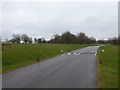
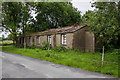

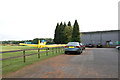
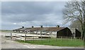
10 photos from this area
Area Information
Key information about the DE13 9PD including its size, population, and administrative classification.
- Area Type
- Postcode
- Area Size
- 3.2 km²
- Population
- 1288
- Population Density
- 51 people/km²
House Prices in DE13 9PD
30
Properties
£858,500
Average Sold Price
£192,500
Lowest Price
£2,899,998
Highest Price
Showing 30 properties
| Address | Type | Beds | Baths | Last Sale Price | Last Sale Date | |
|---|---|---|---|---|---|---|
| Forest View House, Newborough Road, Needwood, DE13 9PD | Flat | 3 | - | £2,899,998 | Sep 2022 | |
| North Lodge, Newborough Road, Needwood, DE13 9PD | Detached | 2 | 2 | £685,000 | Dec 2020 | |
| South Lodge, Newborough Road, Needwood, DE13 9PD | house | - | - | £270,000 | Jul 2015 | |
| West Winds, Newborough Road, Needwood, DE13 9PD | Semi-detached | - | - | £245,000 | Apr 2006 | |
| 1, Cross Plains Cottages, Newborough Road, Needwood, DE13 9PD | house | 2 | 2 | £192,500 | Sep 2005 | |
| Linbrook Cottage, Newborough Road, Needwood, DE13 9PD | Detached | - | - | - | - | |
| Lower Linbrook Farm, Newborough Road, Needwood, DE13 9PD | house | - | - | - | - | |
| 4, Cross Plains Cottages, Newborough Road, Needwood, DE13 9PD | house | - | - | - | - | |
| Lower Linbrook Cottage, Newborough Road, Needwood, DE13 9PD | house | - | - | - | - | |
| 2, Bumble Cottage, Cross Plains Cottages, Newborough Road, Needwood, DE13 9PD | house | - | - | - | - |
Page 1 of 3
Energy Efficiency in DE13 9PD
Amenities
Schools
| Rank | School | Type | Entry gender | Ages |
|---|
Explore more schools in this area
Go to Schools tabDemographics
Household Size
Two person
most common
Accommodation Type
Houses
most common
Tenure
75
majority
Ethnic Group
White
most common
Religion
N/A
most common
Household Composition
N/A
most common
Age
47
median
Adults (30-64 years)
most common
Household Deprivation
N/A
with no deprivation
NS-SEC
43
in Lower managerial occupations
Explore more demographic insights in this area
Go to Demographics tabPlanning
Planning Constraints
- Flood RiskPremium
- Ramsar Wetland SitesPremium
- Area of Outstanding Natural BeautyPremium
- Protected Nature ReservePremium
- Protected WoodlandPremium